The consortium


![]()
Details for product :
| Upload date | 27 Jun 2016 |
| ECV | IV |
| Product file | greenland_ice_velocity_map_winter_2015_2016_v1.0.zip |
| File size | 215.9 MB |
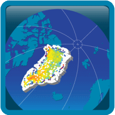
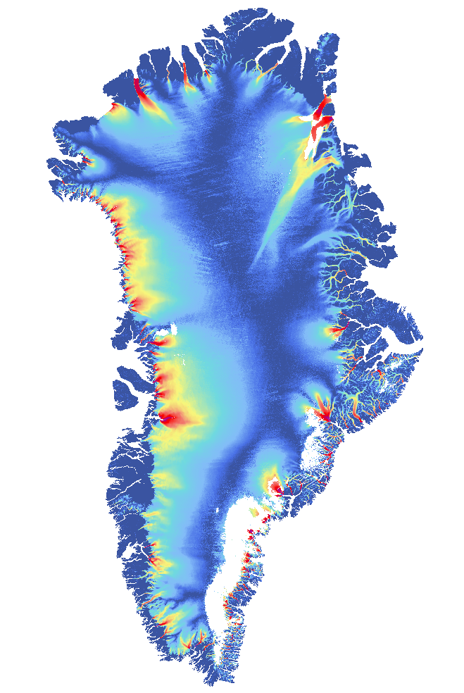
Preview image :
Description :
IV map of Greenland from Sentinel-1 SAR data acquired from 2015-12-23 to 2016-03-31.
Comments :
Greenland SENTINEL-1 ice velocity map from winter of 2015-2016.
Ice velocity map of Greenland derived from Sentinel-1 SAR data acquired from 2015-12-23 to 2016-03-31. The ice velocity map is provided at 500m grid spacing in North Polar Stereographic projection (EPSG: 3413).
The horizontal velocity is provided in true meters per day, towards EASTING(vx) and NORTHING(vy) direction of the grid, and the vertical displacement (vz), derived from a digital elevation model, is also provided.
Provided are both a single NetCDF file (including all measurements and annotation), and separate GeoTiff files with the velocity components: vx, vy, vz and vv (magnitude of the horizontal components).
The filename of the IV Products is made up as follows:
greenland_iv_500m_s1_[Startdate]_[Enddate]_[Version]_[Component].[Format]
greenland = Area
iv = Parameter (ice velocity)
500m = Grid spacing
s1 = Platform
[Startdate] = Date of first acquisition
[Enddate] = Date of last acquisition
[Version] = Version of the product in the format vMAJOR_MINOR
[Component] = vx: Easting, vy: Northing, vz:Vertical, vv: Horizontal magnitude, if applicable
[Format] = Fileformat
The product was generated by ENVEO.
For further details see Detailed IV Product Specifications in the Product Specification Document.