On this page you can see the data sets relevant to the different essential climate variable(s) (ECV).
Clicking on a link will bring you to the corresponding Details page where you may download the product file.
| ECV |
Description |
Size |
Date |
Preview |
| CFL |
ML generated CFLs for key glaciers in Greenland, generated from Sentinel-2 data for 2019-2020. |
2.4 MB |
2022-04-11 |
 |
| CFL |
CFLs for 28 Glaciers in Greenland, derived from ERS, Sentinel-1 and LANDSAT data acquired 1990-2016. |
72.3 MB |
2017-03-17 |
 |
| CFL |
CFLs for 28 Glaciers in Greenland, derived from ERS and Sentinel-1 data acquired from 1995-2015. |
2.0 MB |
2016-07-05 |
 |
| GLL |
Grounding lines for 5 North Greenland glaciers from ERS-1/-2 SAR and Sentinel-1 SAR interferometry. |
305.6 KB |
2017-08-31 |
 |
| GLL |
GLL for 5 Glaciers in Greenland, derived from ERS and Sentinel-1 data. |
1.1 MB |
2016-06-14 |
 |
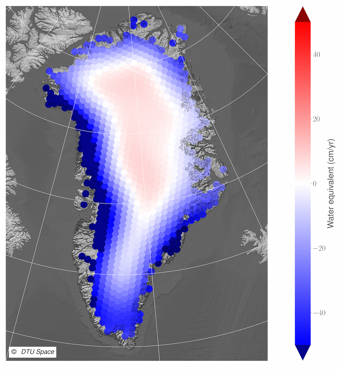
| GMB |
GMB products for the Greenland Ice Sheet from GRACE satellite gravimetry (CSR RL06) by DTU Space. |
54.3 MB |
2021-12-14 |
 |
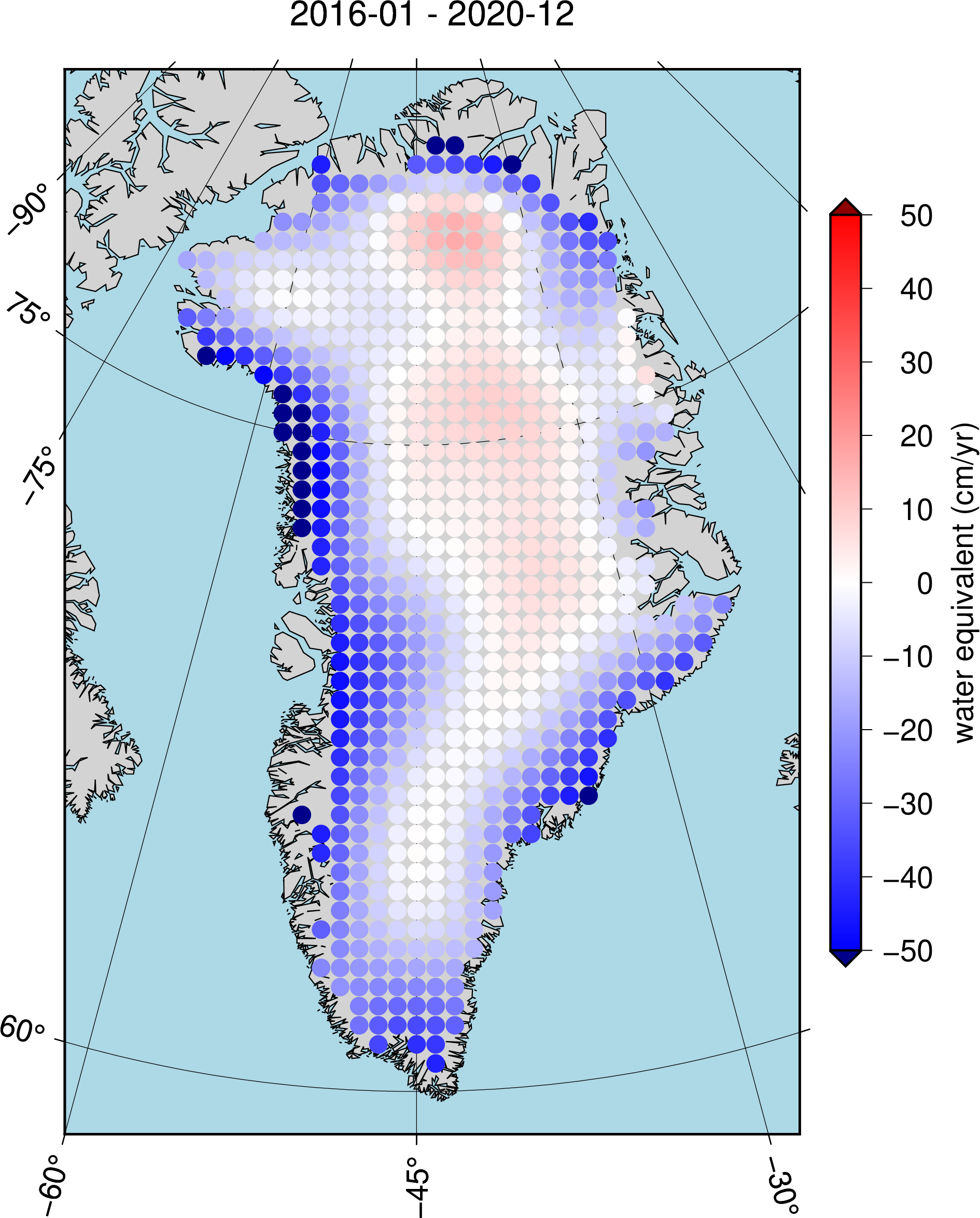
| GMB |
GMB products for the GIS from GRACE/GRACE-FO satellite gravimetry (CSR RL06) data by TU Dresden. |
11.8 MB |
2021-10-25 |
 |
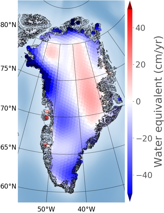
| GMB |
GMB products for the Greenland Ice Sheet from GRACE satellite gravimetry (CSR RL06) by DTU Space. |
5.6 MB |
2020-09-24 |
 |
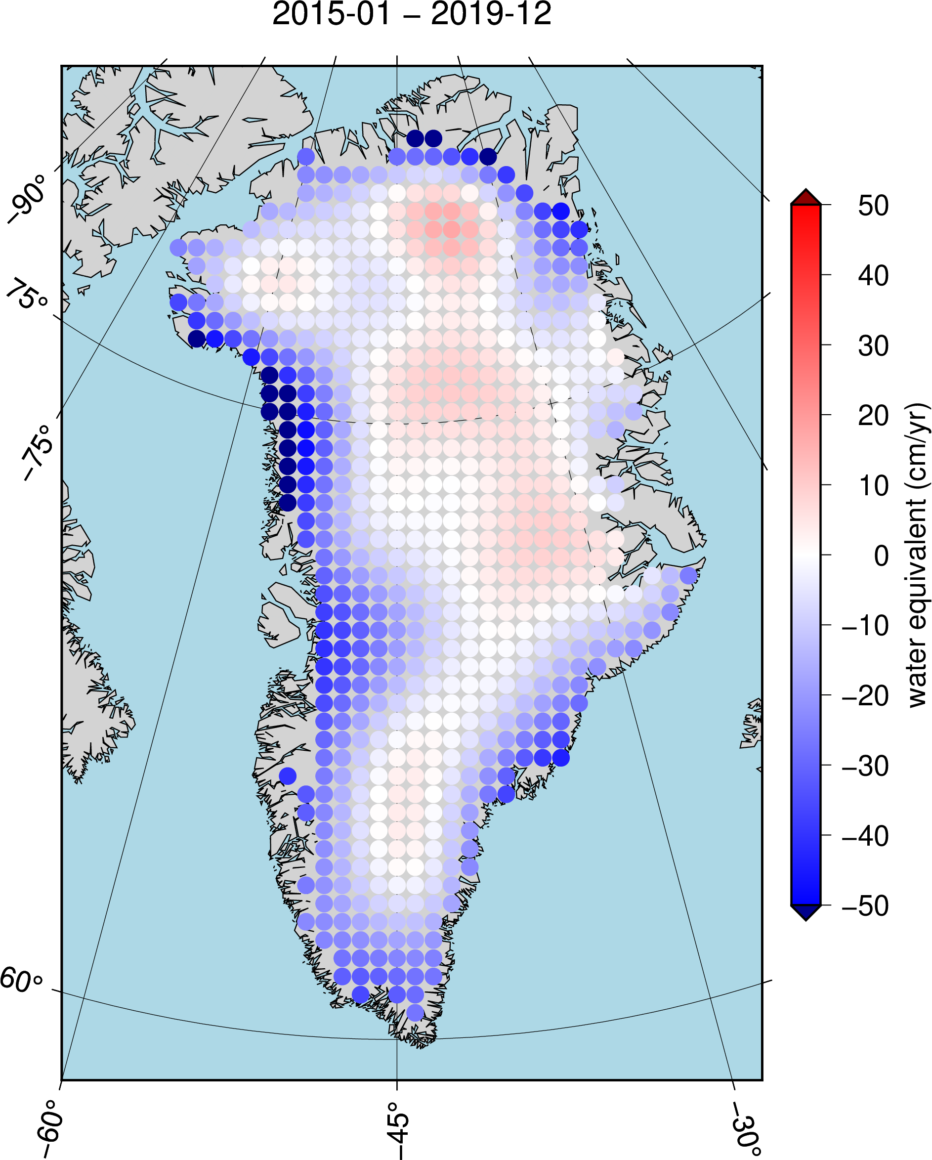
| GMB |
GMB products for the GIS from GRACE/GRACE-FO satellite gravimetry (CSR RL06) data by TU Dresden.
|
11.0 MB |
2020-09-24 |
 |
| GMB |
GMB products for the GIS from GRACE/GRACE-FO satellite gravimetry (CSR RL06) data by TU Dresden.
|
11.0 MB |
2020-04-29 |
 |
| GMB |
GMB products for the GIS CCI+ derived from GRACE satellite gravimetry (CSR RL06) data by DTU Space. |
5.6 MB |
2020-04-29 |
 |
| GMB |
GMB products for the Greenland Ice Sheet from GRACE satellite gravimetry (CSR RL06) by TU Dresden. |
8.6 MB |
2018-06-13 |
 |
| GMB |
GMB products for the Greenland Ice Sheet from GRACE satellite gravimetry (CSR RL06) by DTU Space. |
10.2 MB |
2018-06-07 |
 |
| GMB |
GMB products for the Greenland Ice Sheet derived from GRACE satellite gravimetry data by TU Dresden. |
8.6 MB |
2018-05-25 |
 |
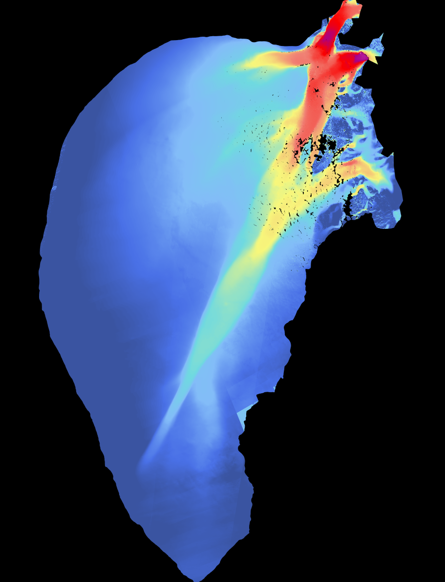
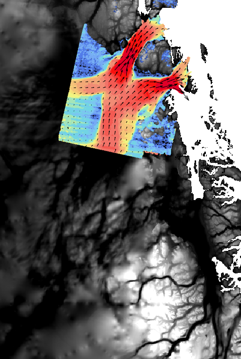
| IV |
Optical IV of Jakobshavn Glacier for summer seasons 2020 and 2021 generated using S2 data. |
169.0 MB |
2022-03-21 |
 |
| IV |
Optical IV of Petermann Glacier for summer seasons 2020 and 2021 generated using S2 data. |
161.8 MB |
2022-03-21 |
 |
| IV |
Optical IV of Kangerlussuaq Glacier for summer seasons 2020 and 2021 generated using S2 data. |
122.9 MB |
2022-03-21 |
 |
| IV |
Optical IV of Storstrommen Glacier for summer seasons 2020 and 2021 generated using S2 data. |
1.1 GB |
2022-03-21 |
 |
| IV |
Optical IV of Upernavik Glacier for summer seasons 2020 and 2021 generated using S2 data. |
129.8 MB |
2022-03-18 |
 |
| IV |
Optical IV of Helheim Glacier for summer seasons 2020 and 2021 generated using S2 data. |
72.5 MB |
2022-03-18 |
 |
| IV |
Optical IV of Hagen Glacier for summer seasons of 2020 and 2021 generated using S2 data. |
140.8 MB |
2022-03-18 |
 |
| IV |
Optical IV of 79fjord Glacier for summer seasons 2020 and 2021 generated using S2 data. |
440.2 MB |
2022-03-18 |
 |
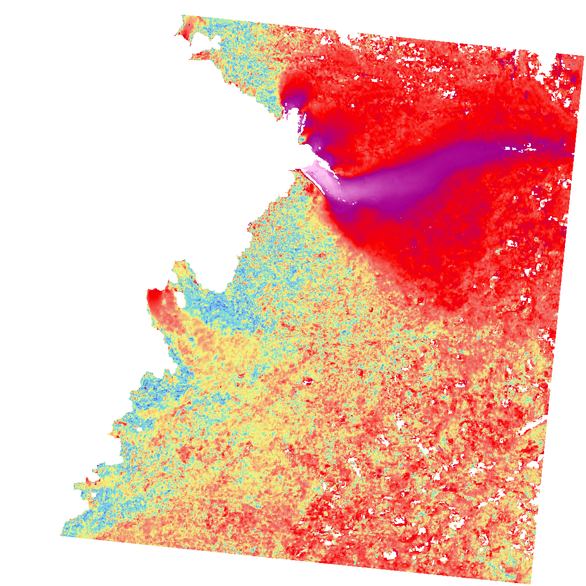
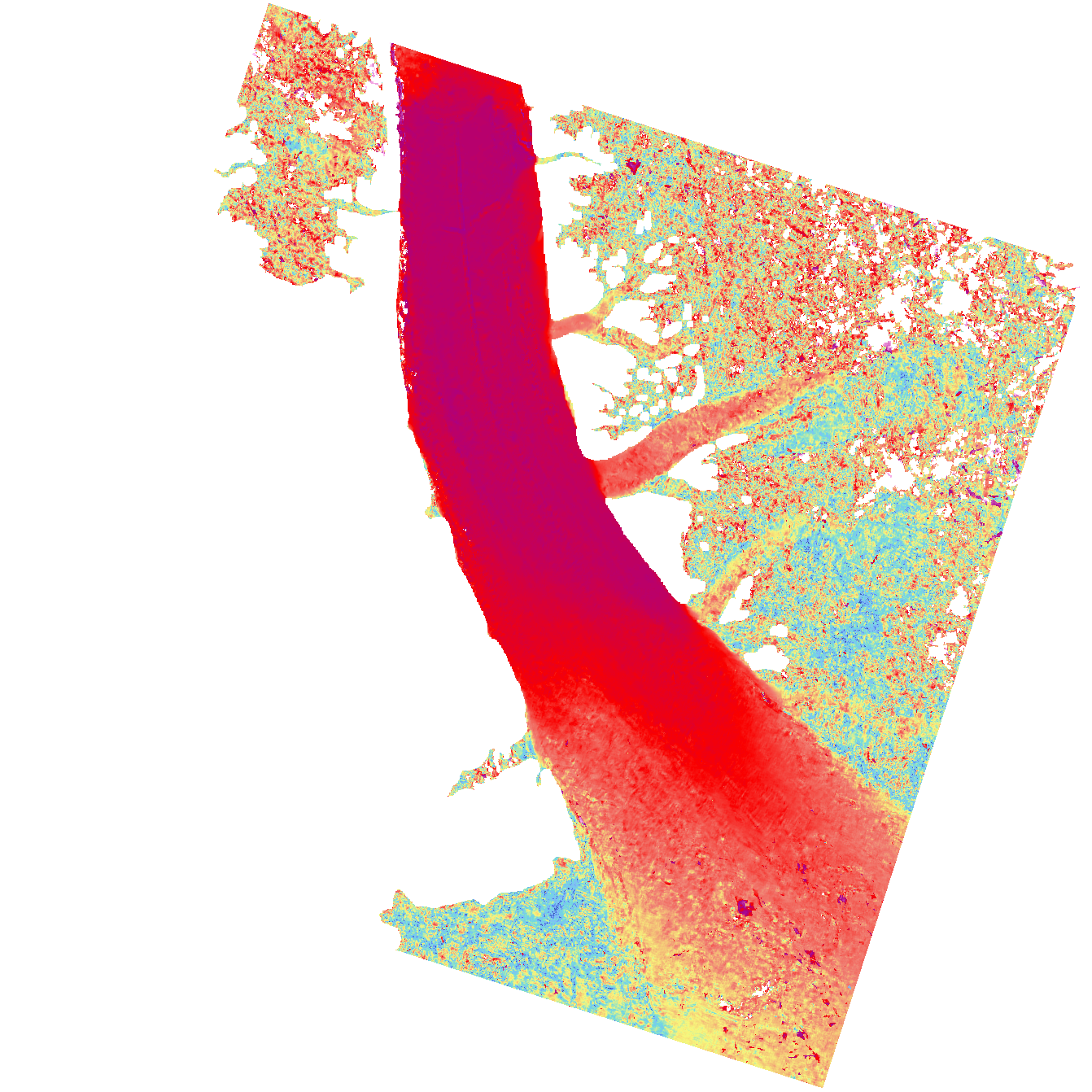
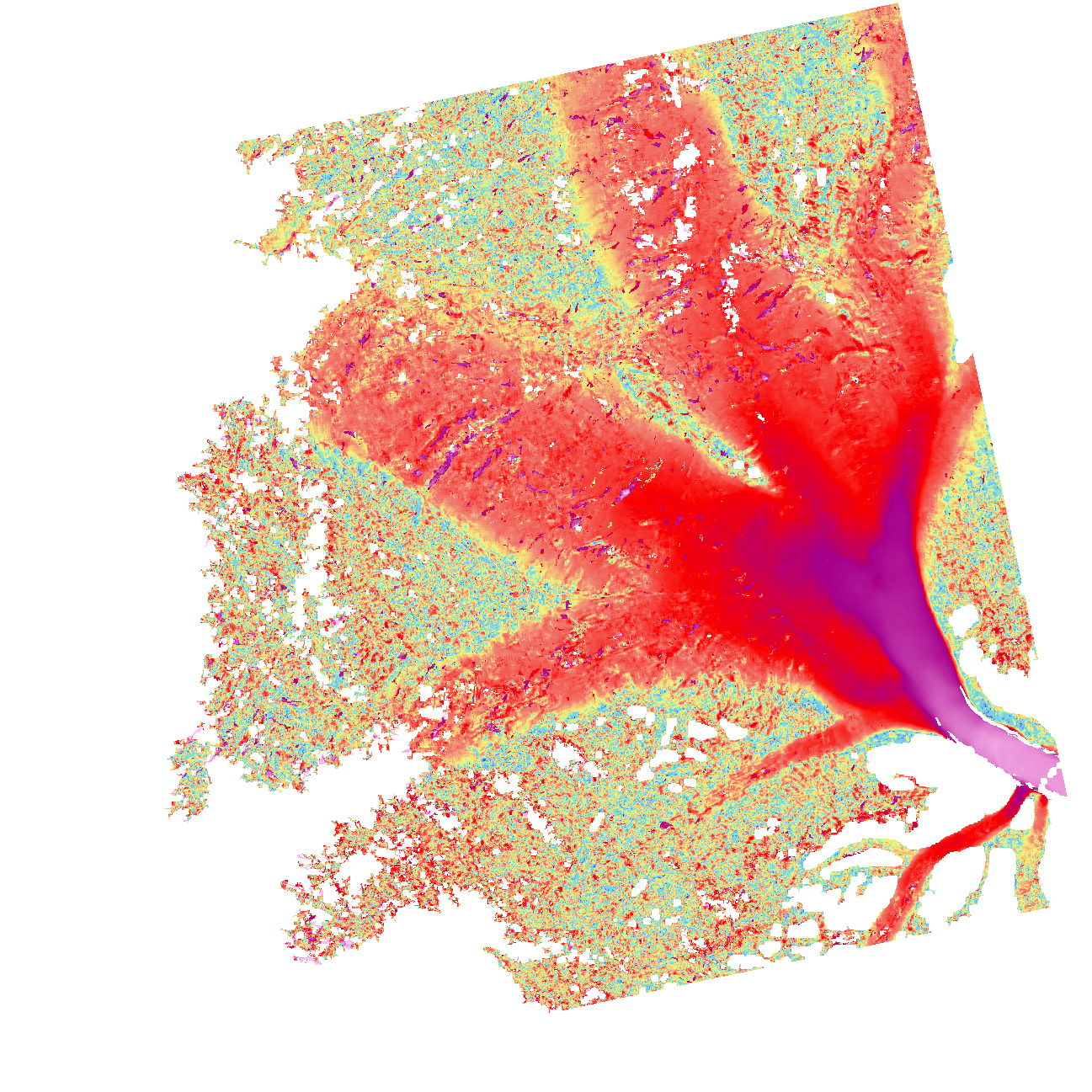
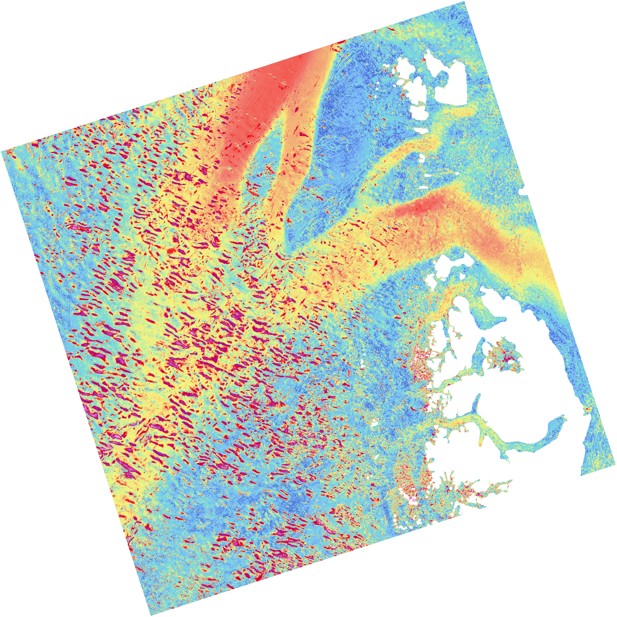
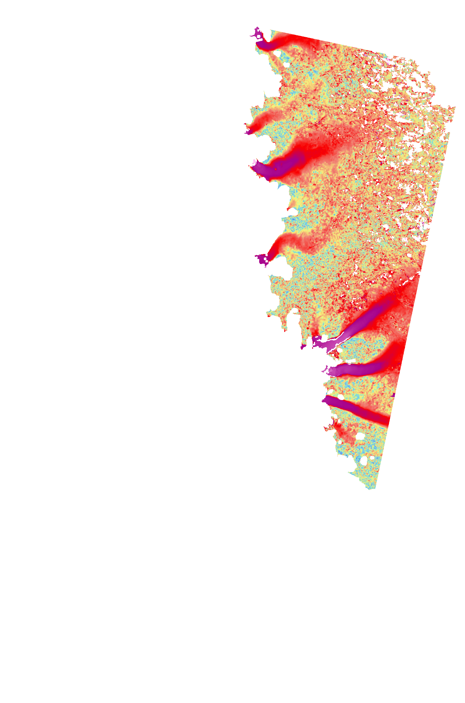
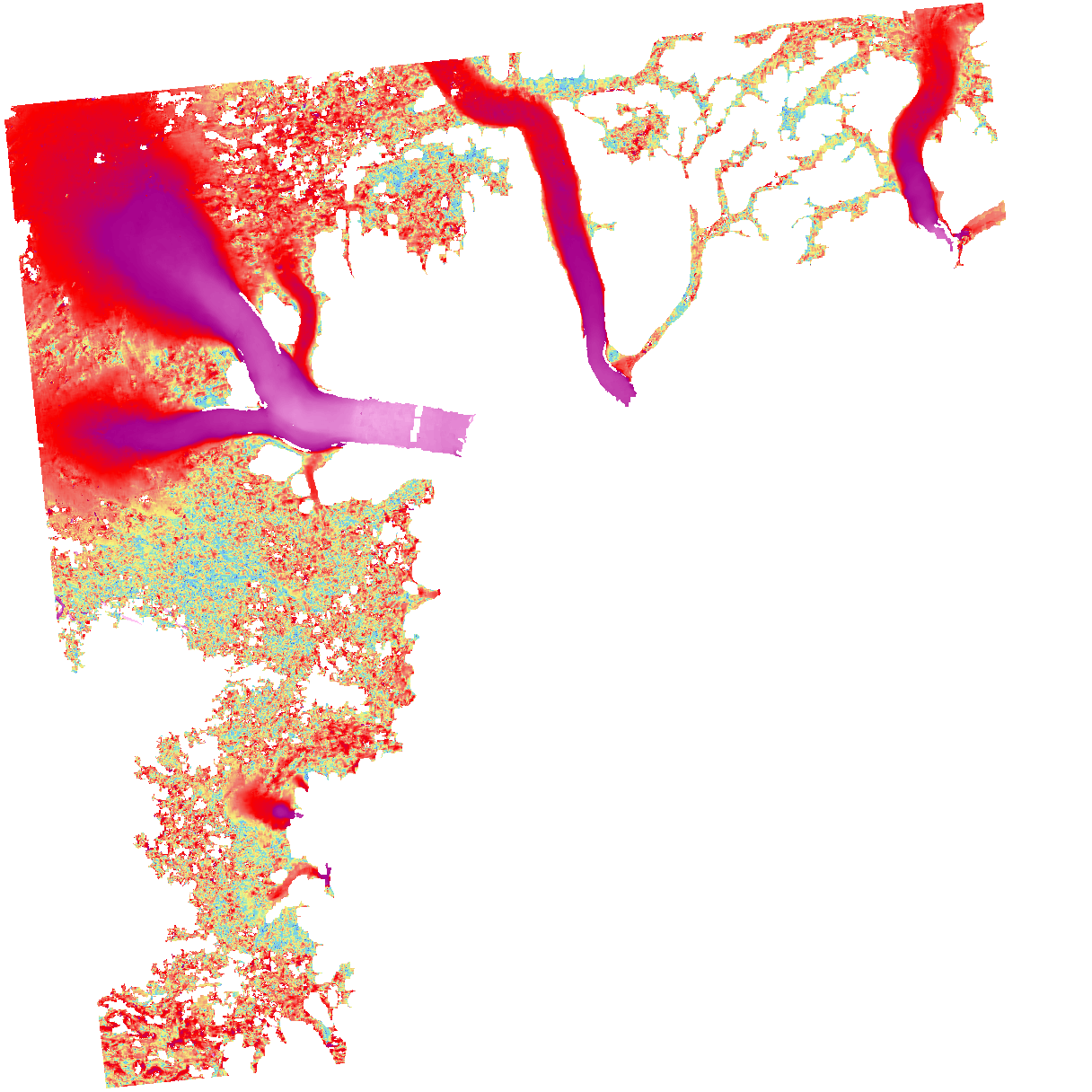
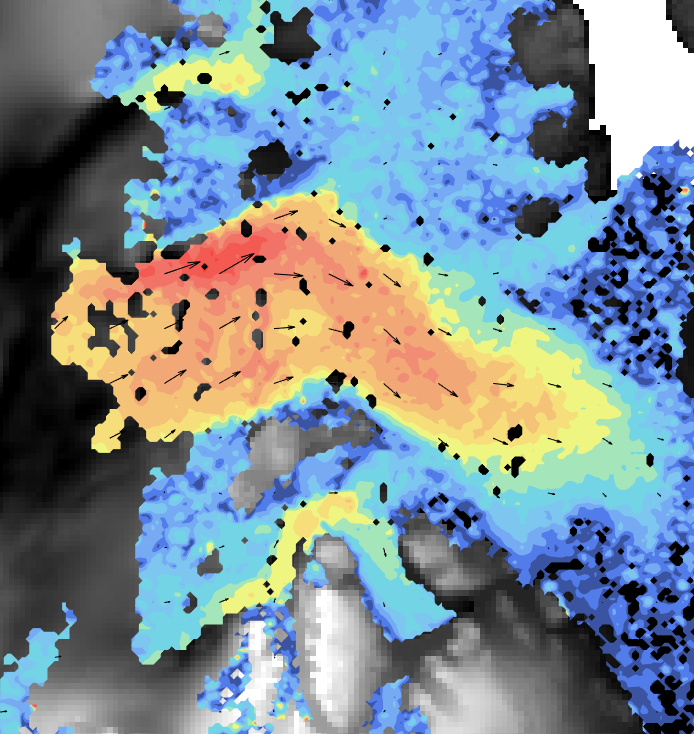
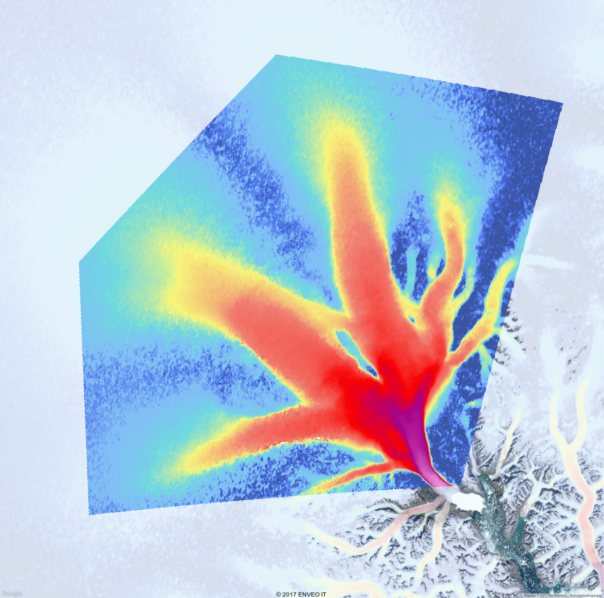
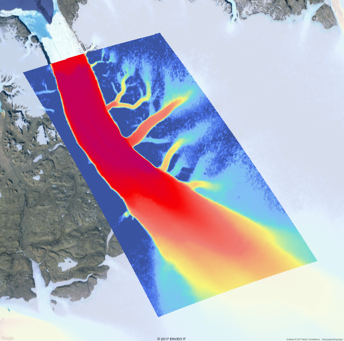
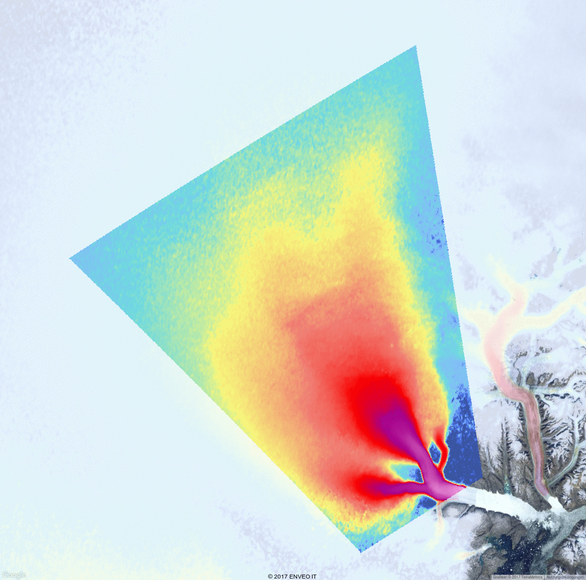
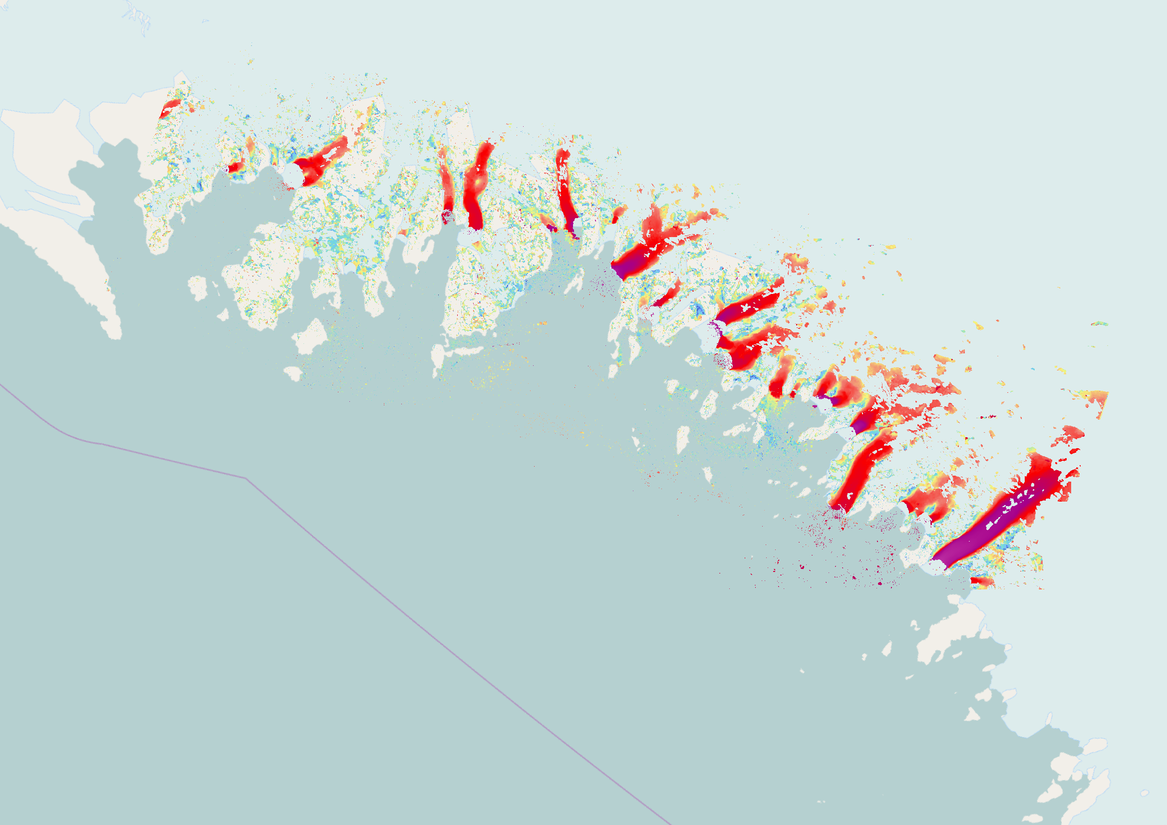
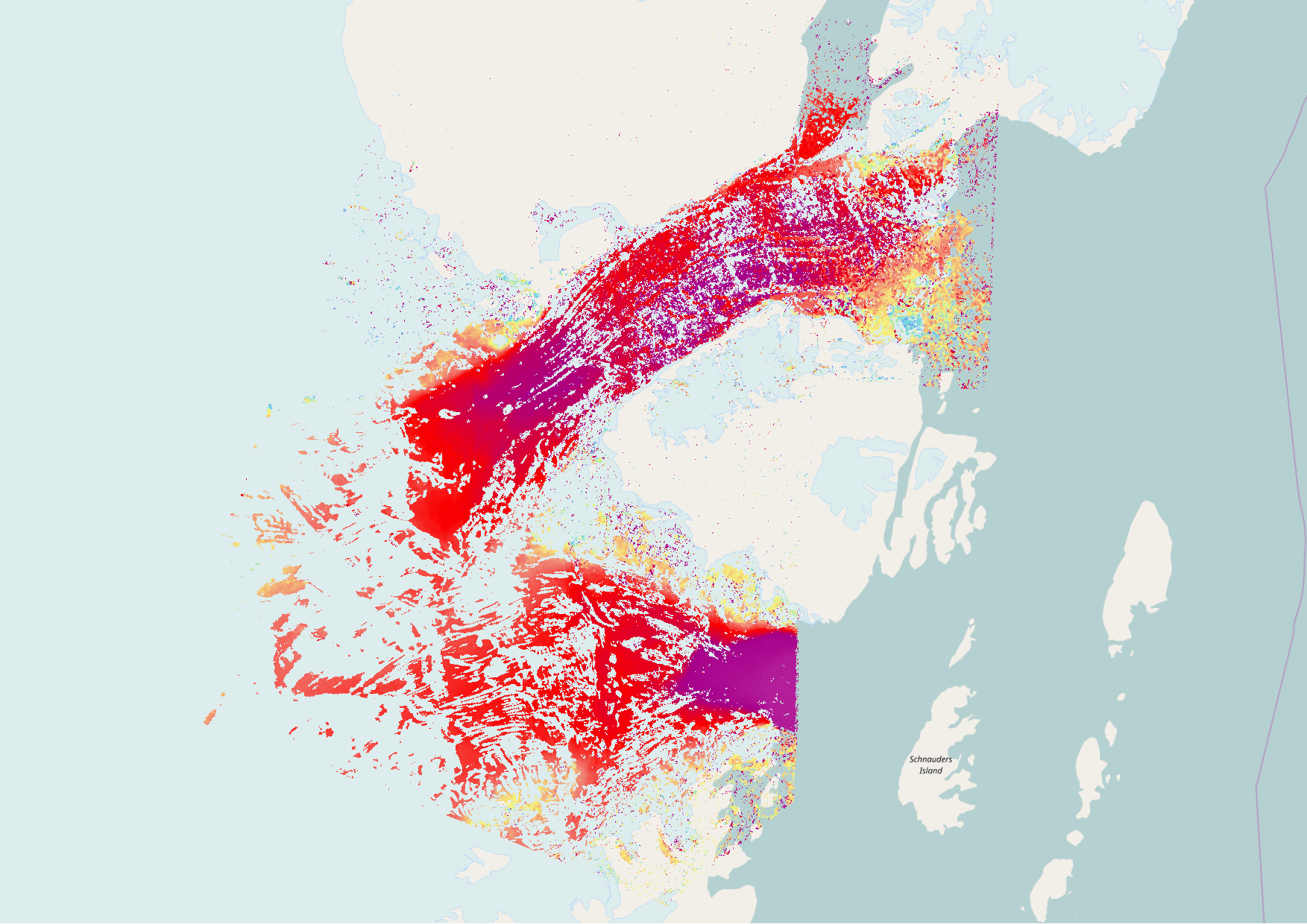
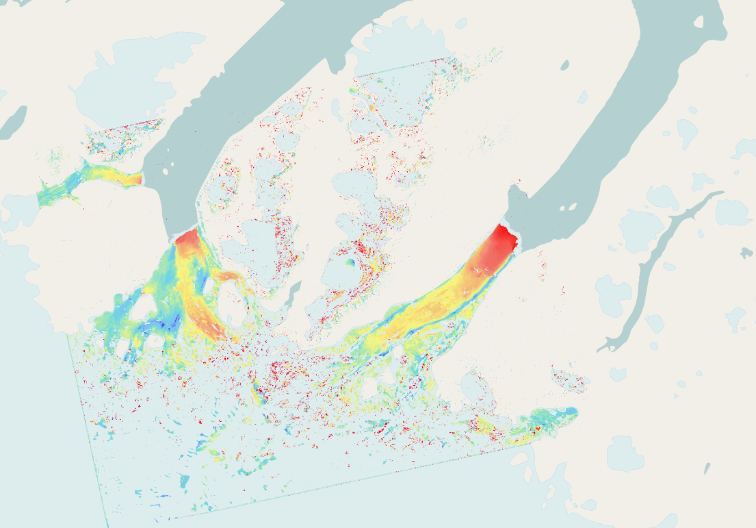
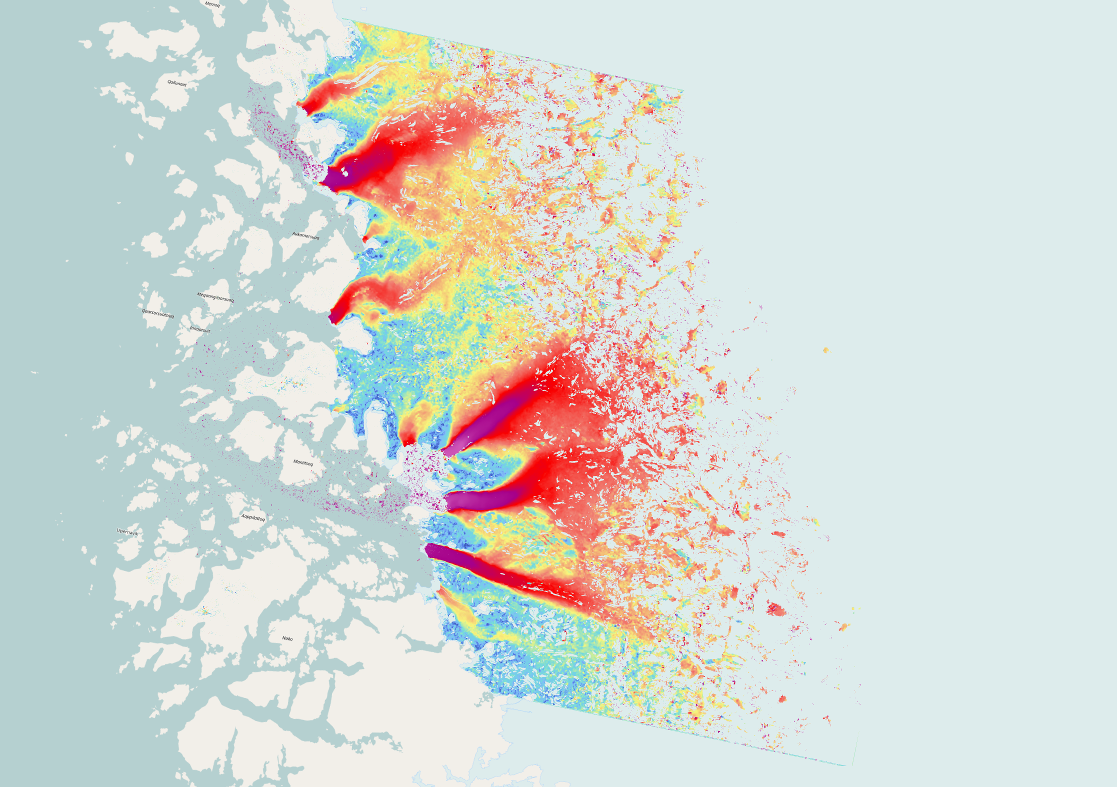
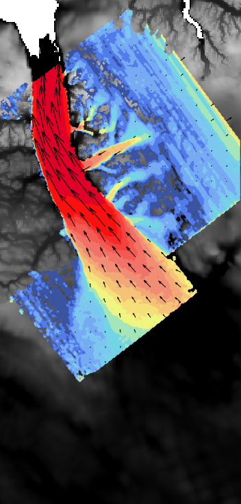
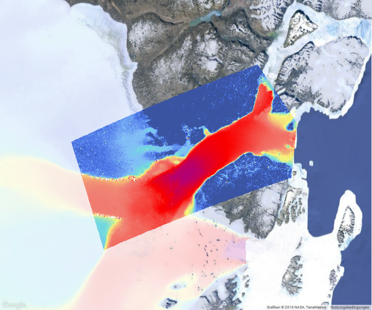
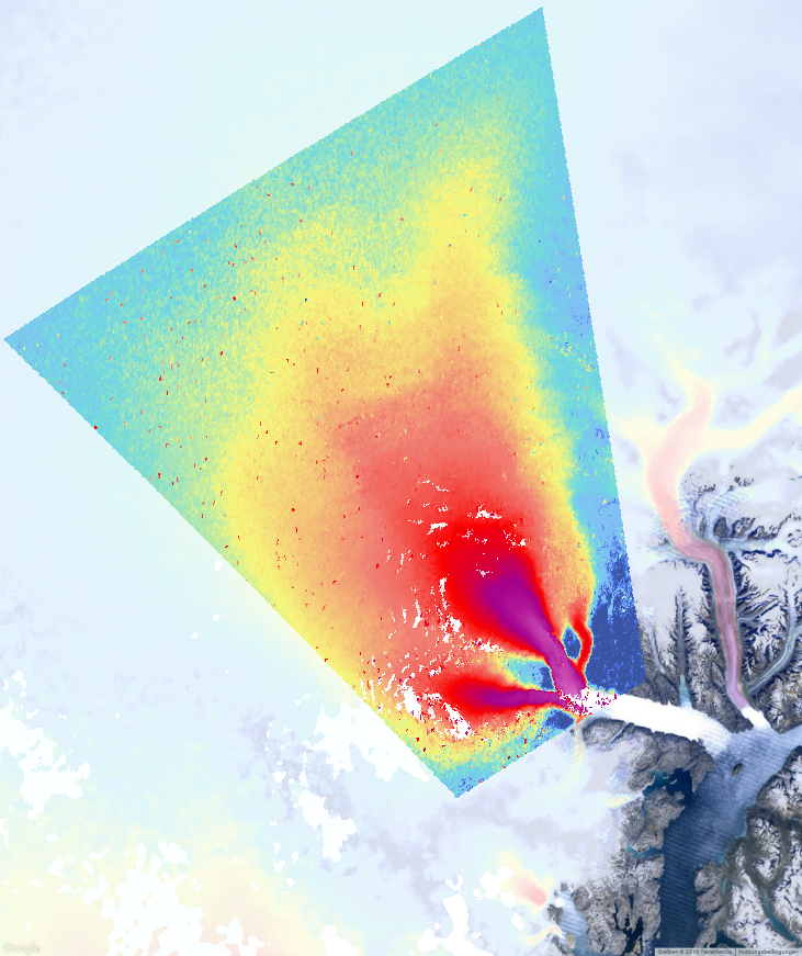
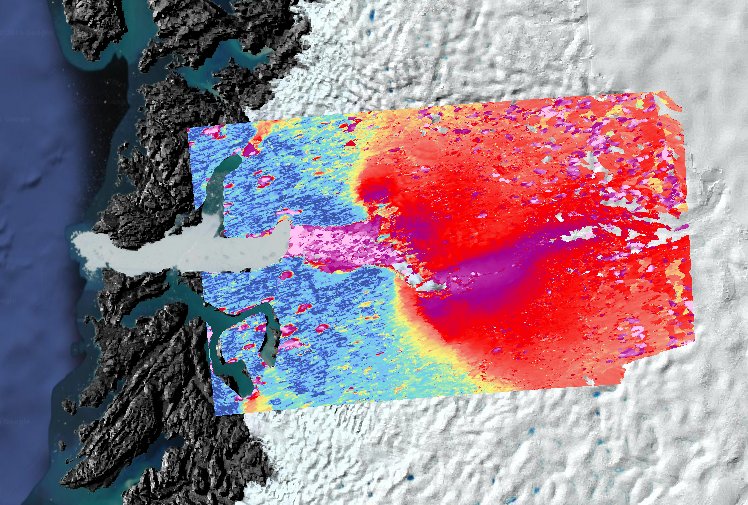
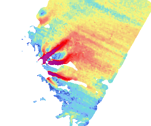
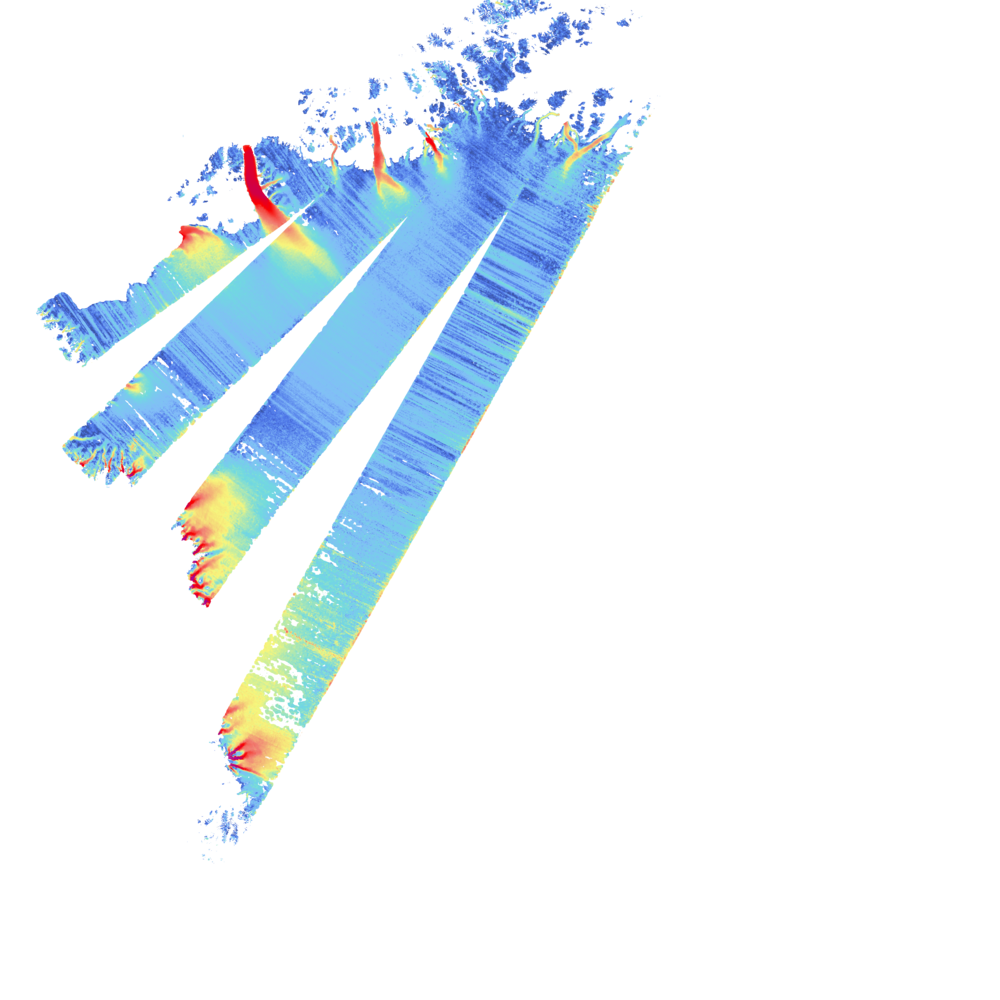
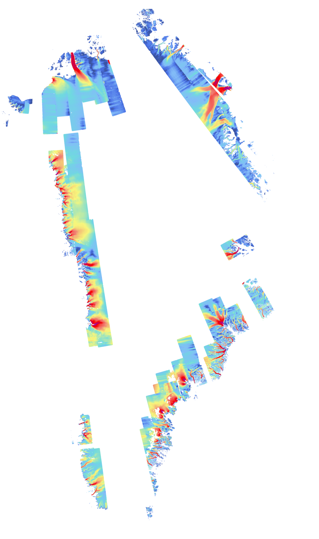
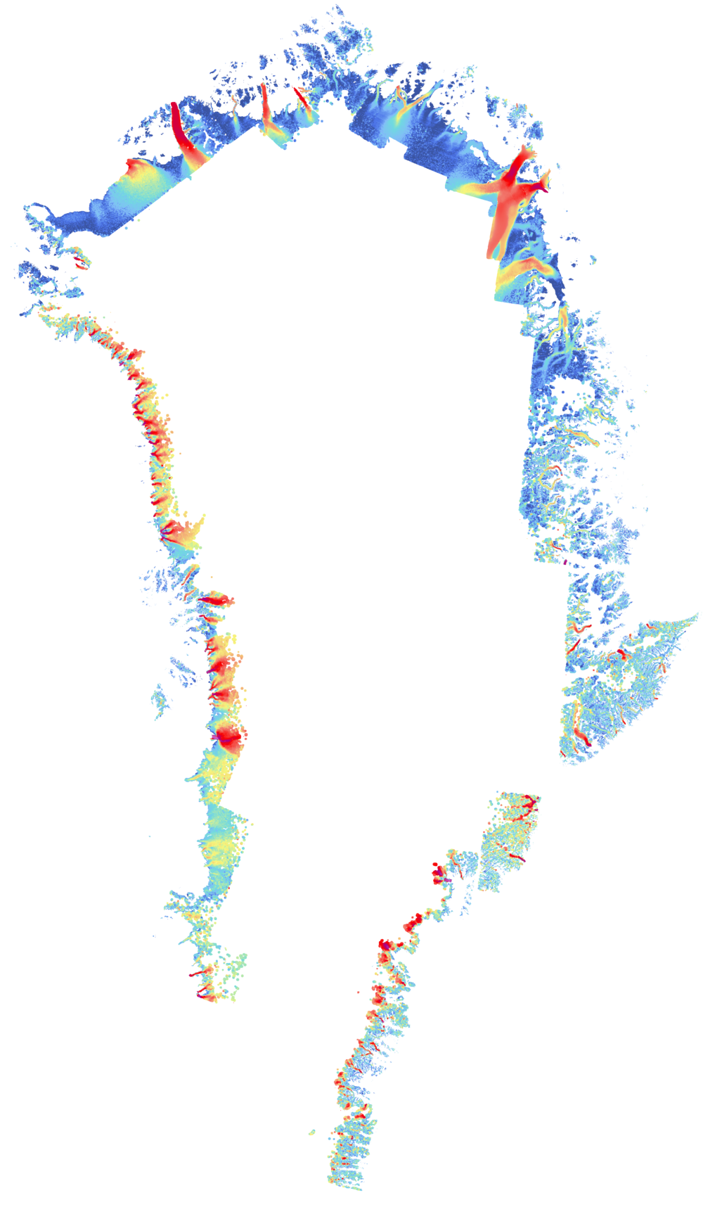
| IV |
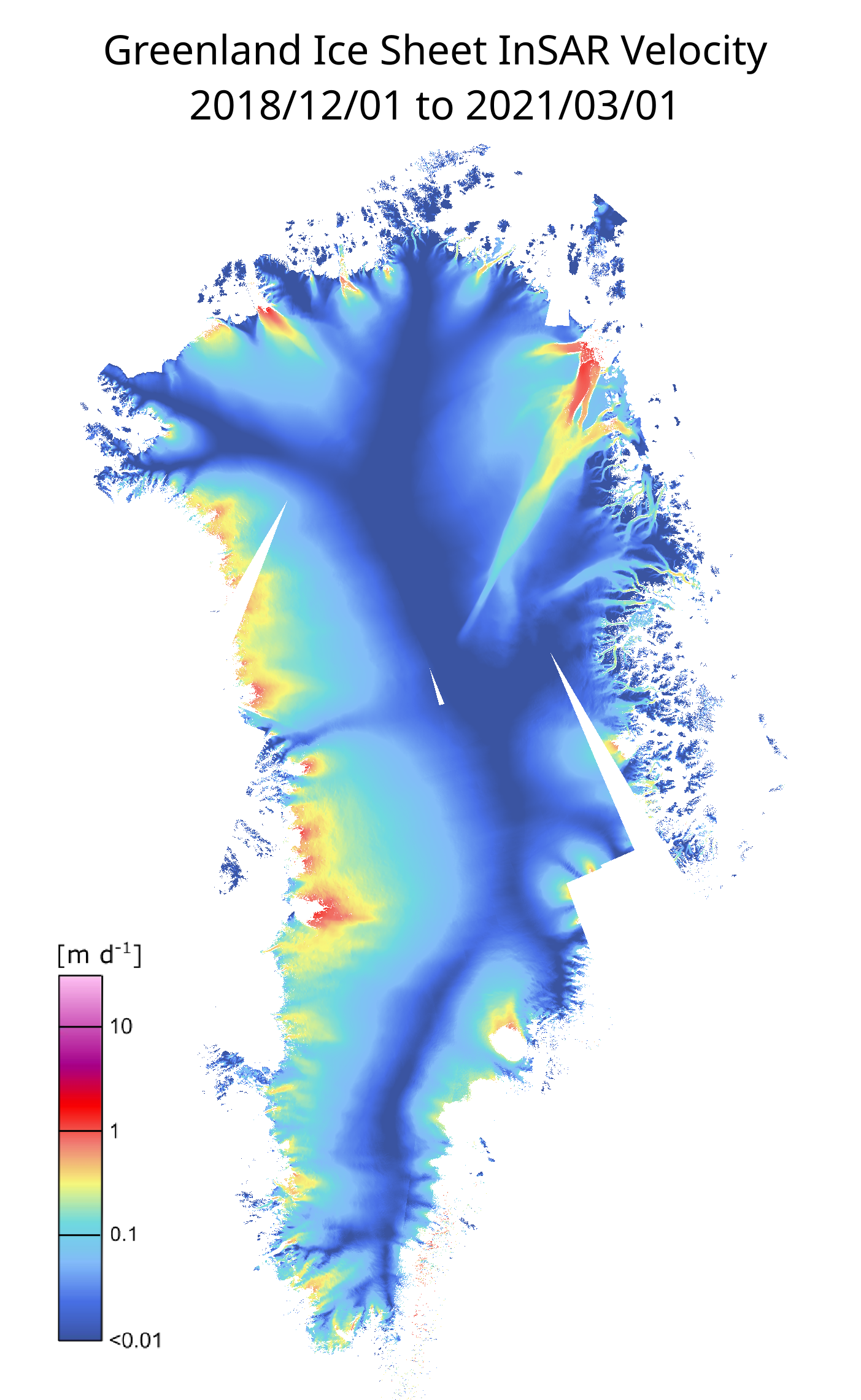
Greenland Ice Sheet InSAR velocity map from Sentinel-1, winter campaigns 2018/12/01 to 2021/03/01. |
2.3 GB |
2022-02-10 |
 |
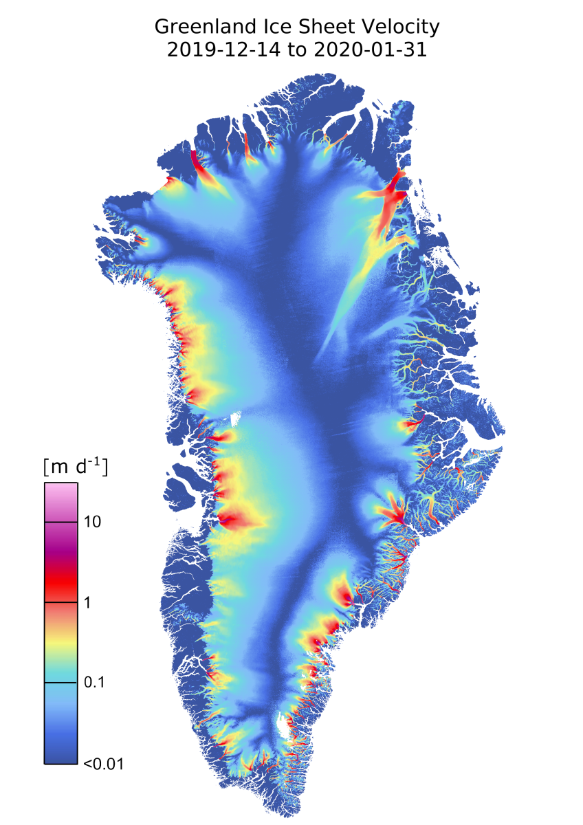
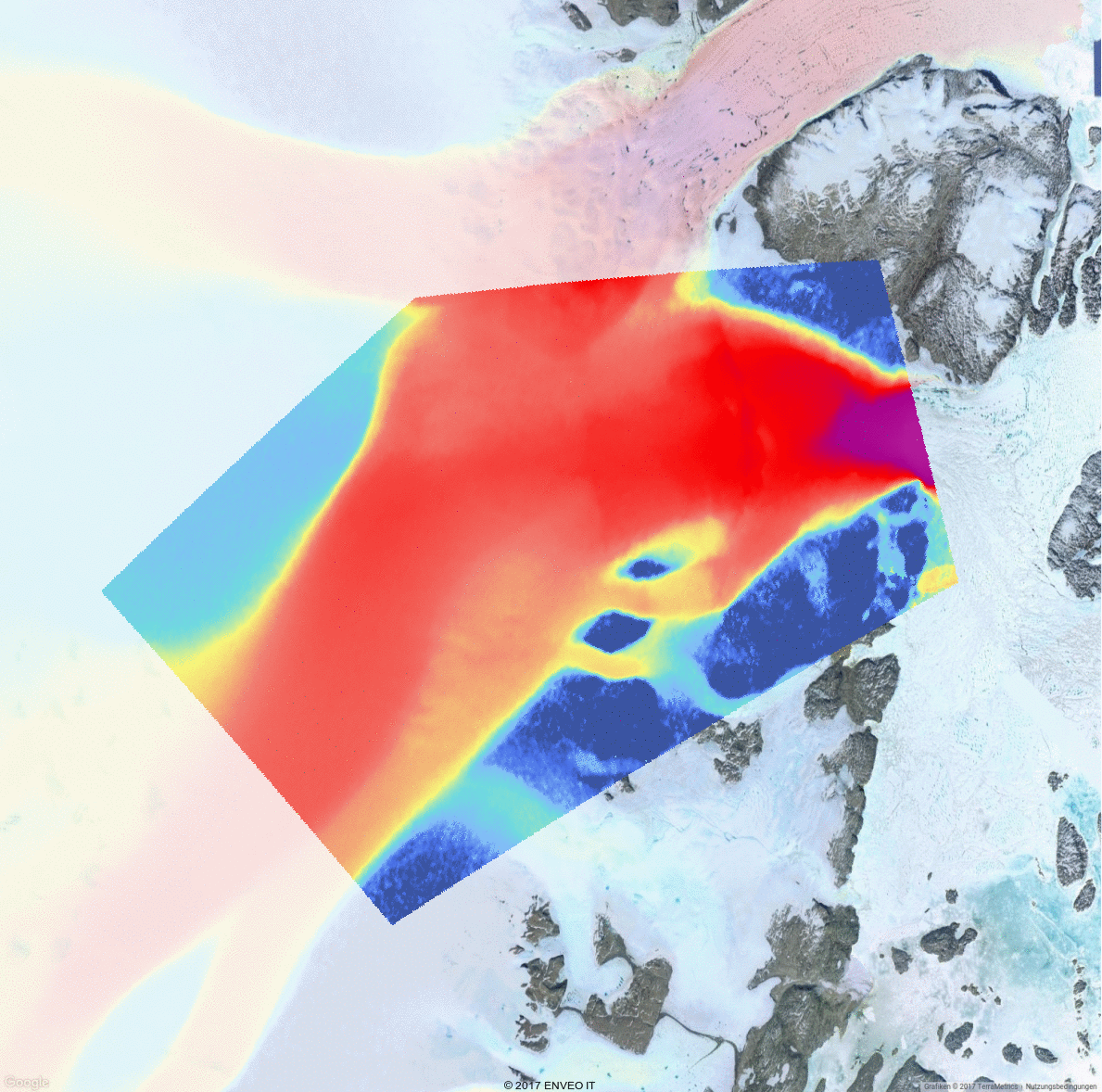
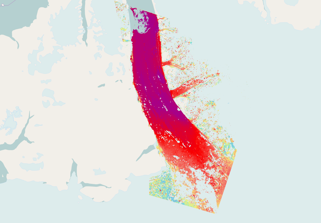
| IV |
Greenland Ice Sheet Velocity 2019/20 from SENTINEL-1 winter campaign from 2019/12/14 to 2020/01/31. |
632.8 MB |
2022-01-27 |
 |
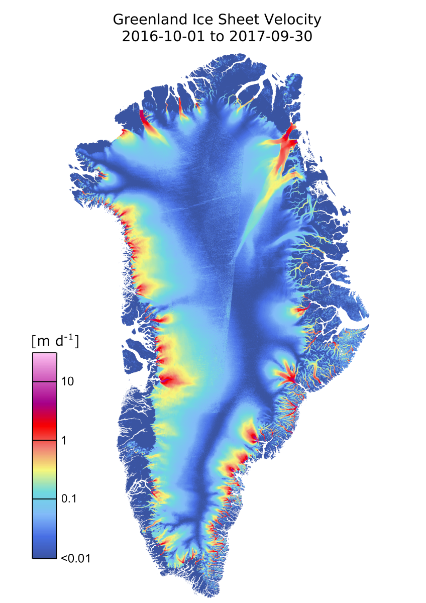
| IV |
Greenland Ice Sheet Velocity 2016/17 from SENTINEL-1 data acquired between 2016/10/01 - 2017/09/30. |
639.7 MB |
2022-01-27 |
 |
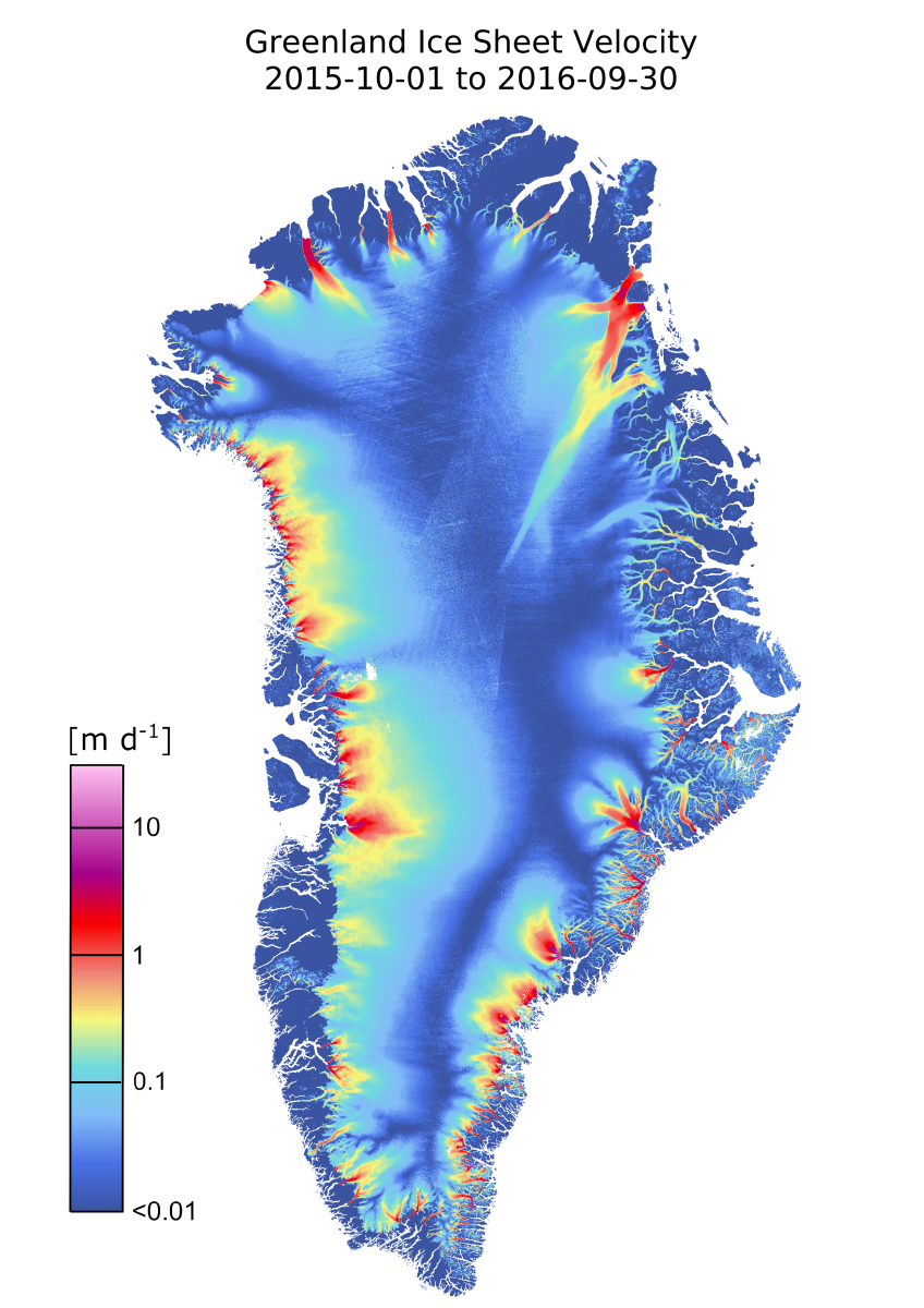
| IV |
Greenland Ice Sheet Velocity 2015/16 from SENTINEL-1 data acquired between 2015/10/01 - 2016/09/30. |
641.6 MB |
2022-01-24 |
 |
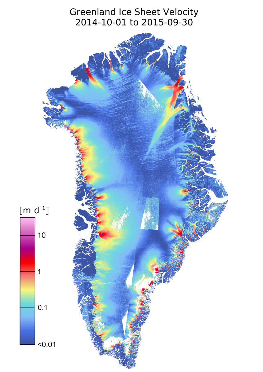
| IV |
Greenland Ice Sheet Velocity 2014/15 from SENTINEL-1 data acquired between 2014/10/01 - 2015/09/30. |
622.1 MB |
2022-01-19 |
 |
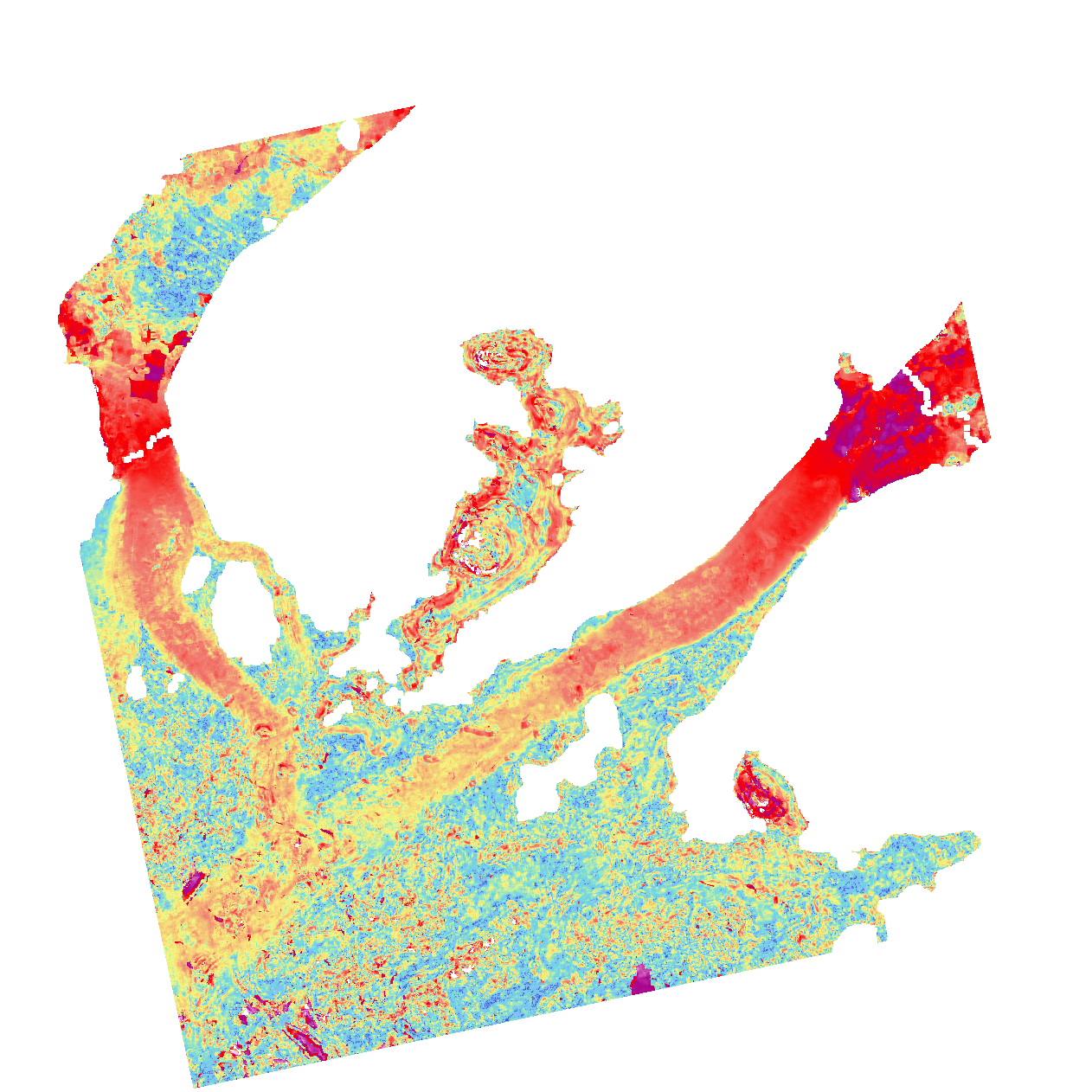
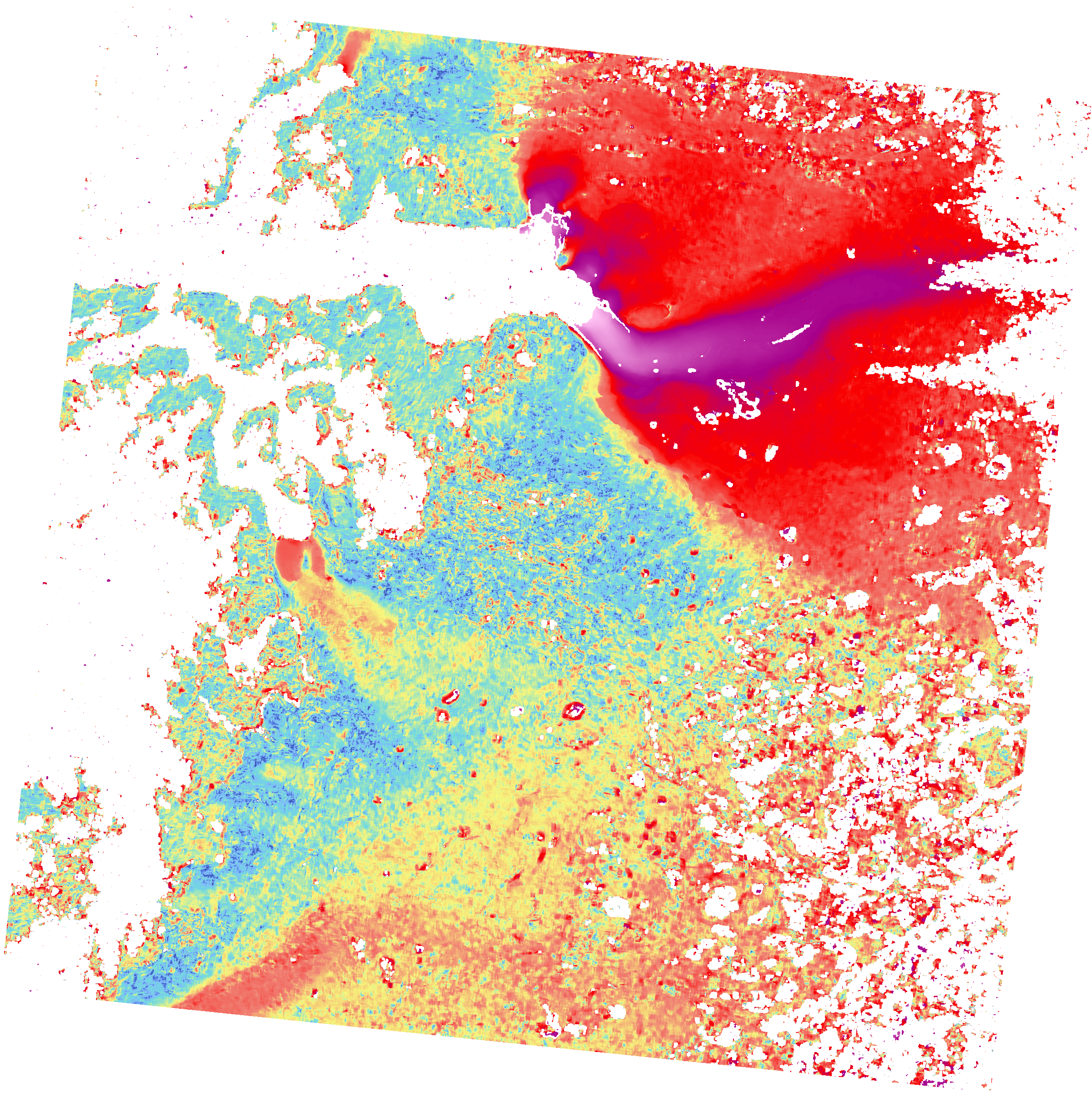
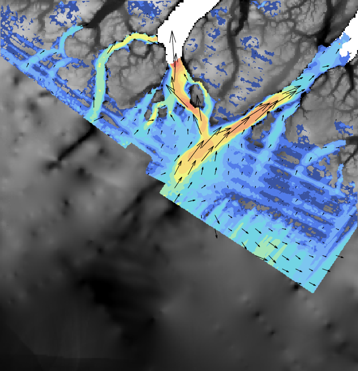
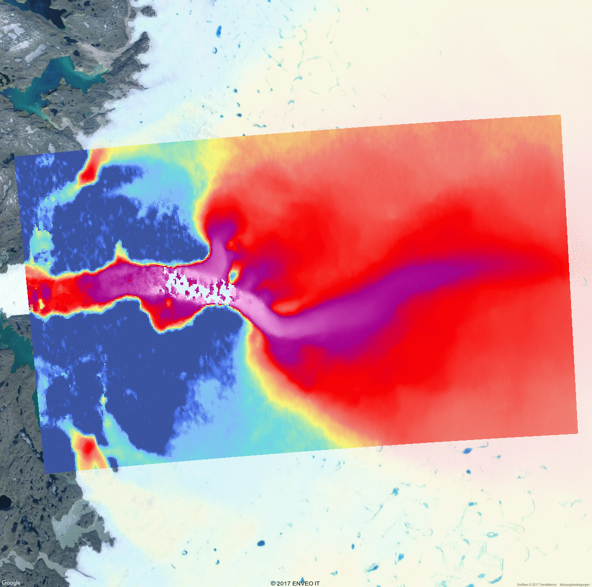
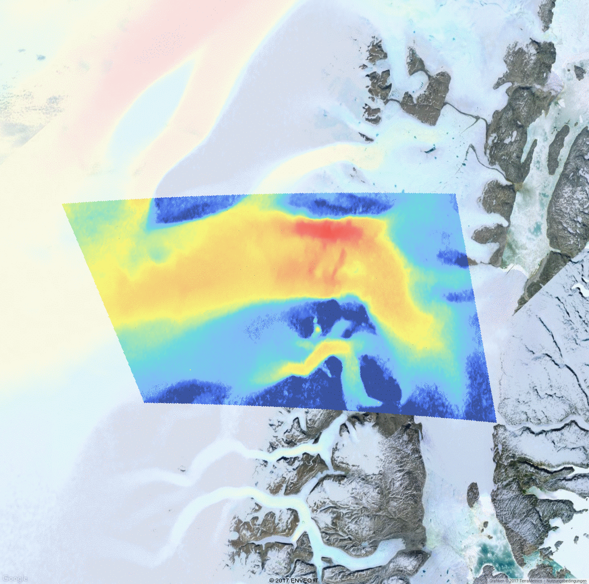
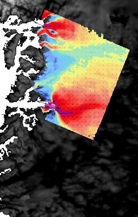
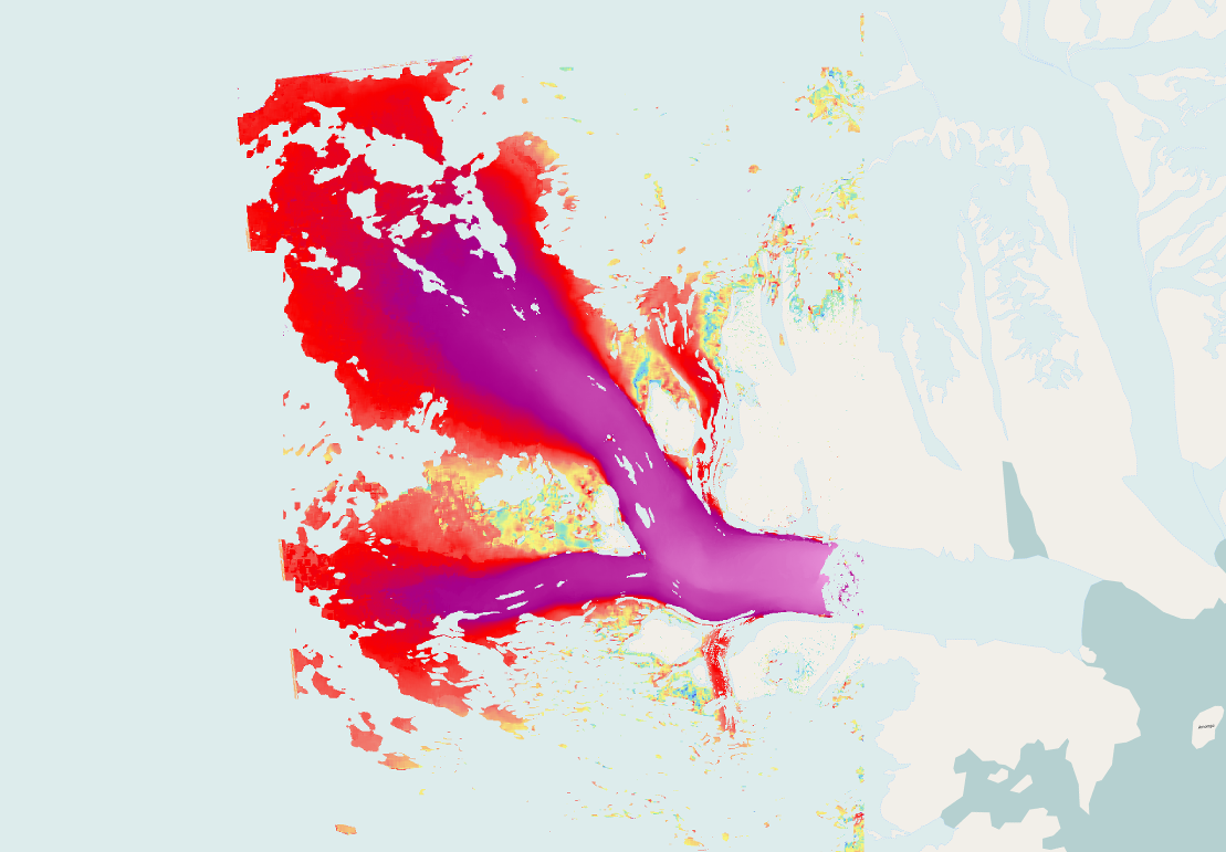
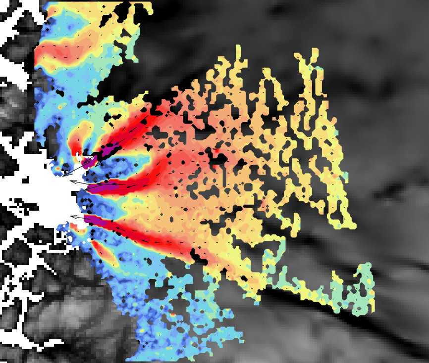
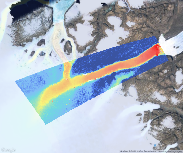
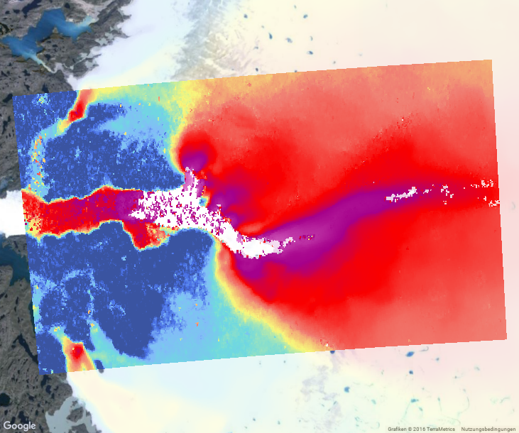
| IV |
InSAR/offset-tracking IV of Zwally Basin 2.1 between 2019-12-16 and 2020-01-25 from Sentinel-1. |
444.9 MB |
2020-09-25 |
 |
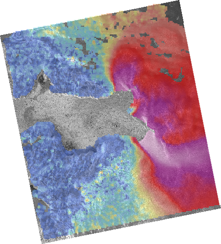
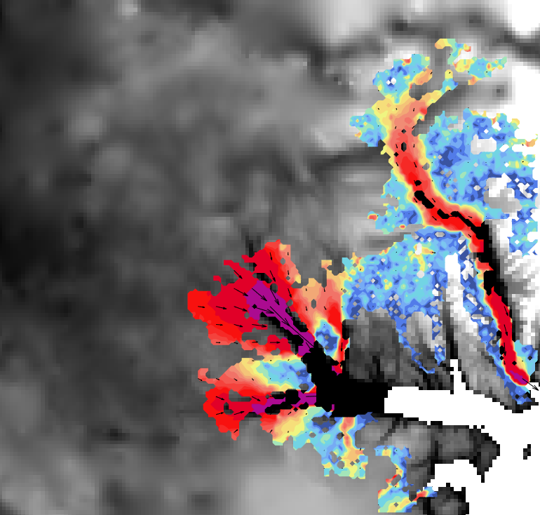
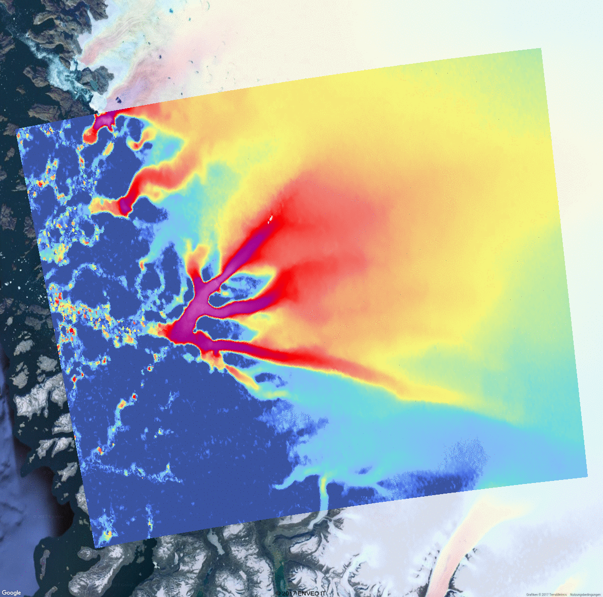
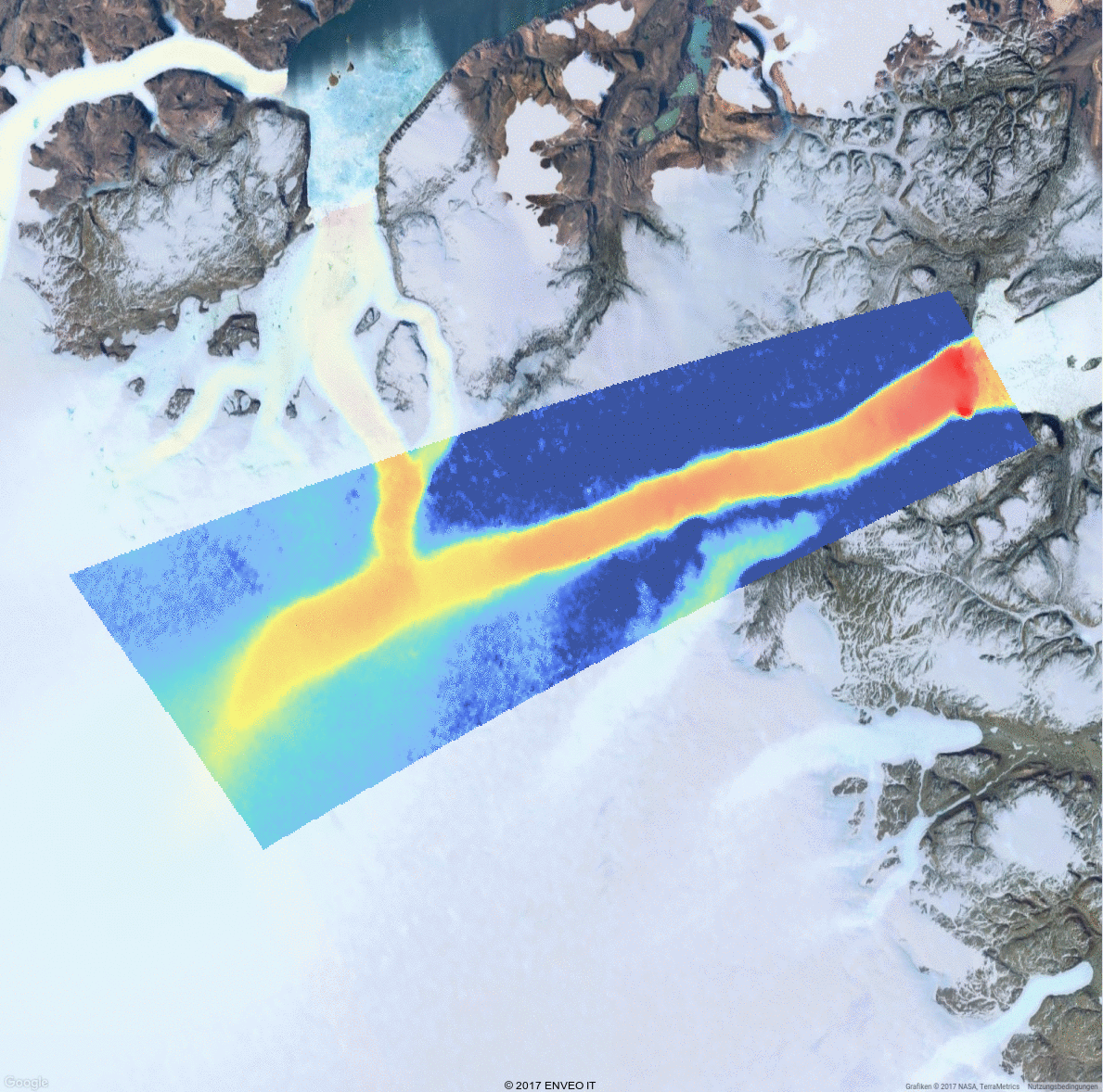
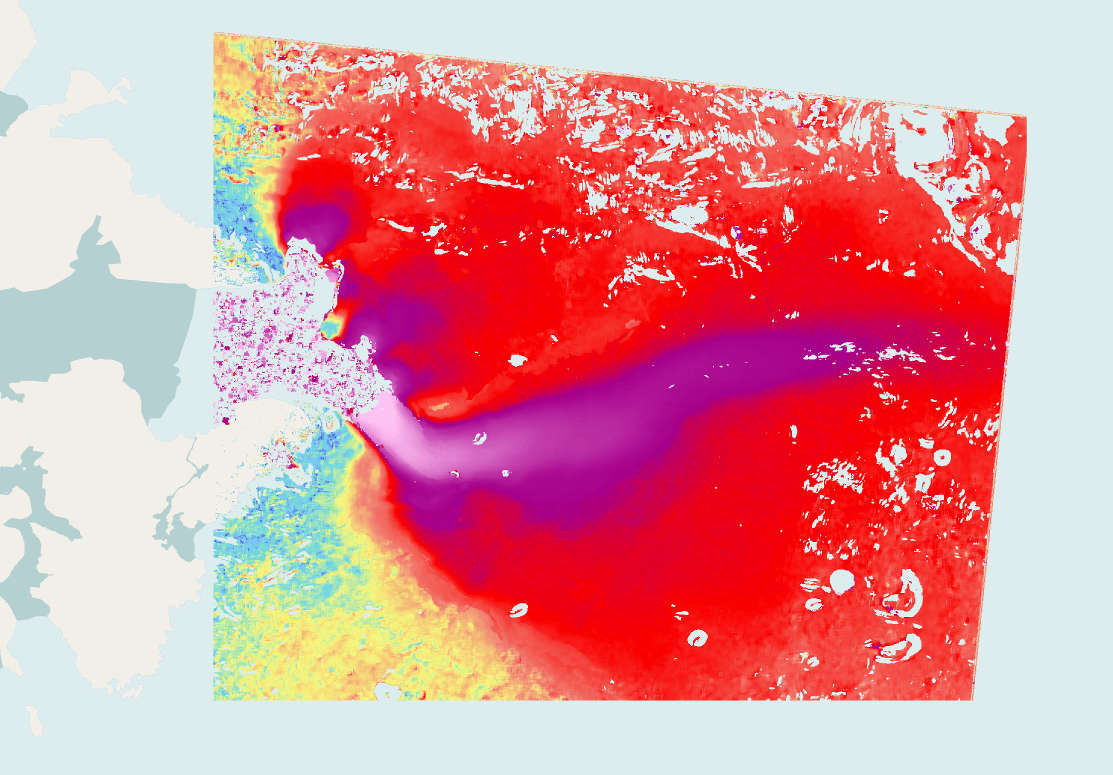
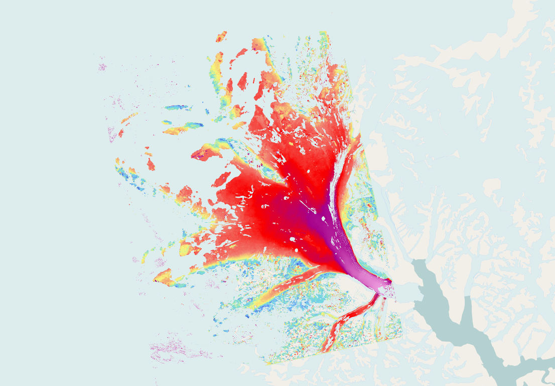
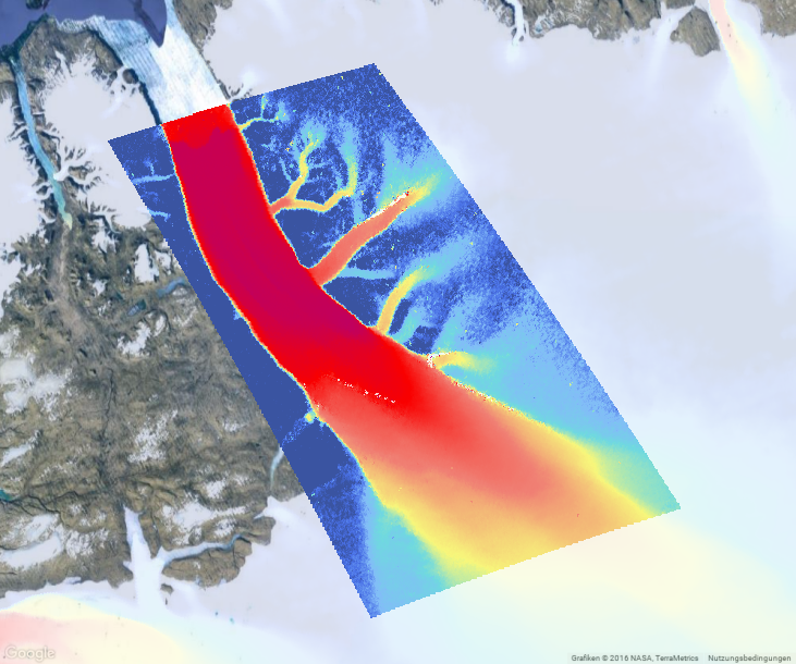
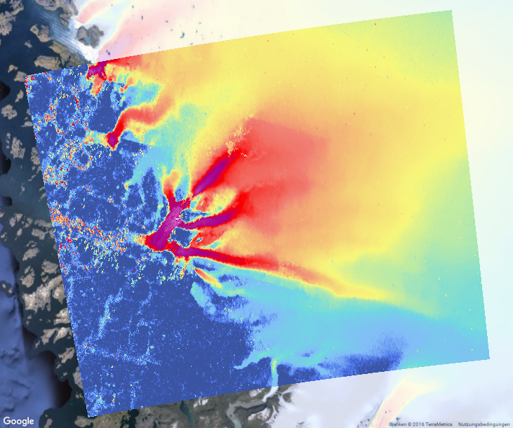
| IV |
Optical IV of 8 main outlet glaciers between 2019-05-01 and 2019-08-29, generated using S2 data. |
336.8 MB |
2020-09-24 |
 |
| IV |
Timeseries of Jakobshavn Ice Velocity 2012-2014 using 4-day COSMO-SkyMed offset-tracking pairs |
8.4 MB |
2018-04-19 |
 |
| IV |
IV time series of Storstrommen glacier 1991-2010 generated using ERS-1, ERS-2 and Envisat data. |
75.3 MB |
2017-10-30 |
 |
| IV |
IV time series of Hagen glacier 1991-2010 generated using ERS-1, ERS-2 and Envisat data. |
108.0 MB |
2017-10-26 |
 |
| IV |
IV time series of Helheim glacier 1996-2010 generated using ERS-1, ERS-2 and Envisat data.
|
5.8 MB |
2017-10-25 |
 |
| IV |
IV time series of the Zachariae and 79Fjord area 1991-2011 generated using ERS-1+2 and Envisat data. |
280.9 MB |
2017-10-25 |
 |
| IV |
IV time series of Petermann glacier 1991-2010 generated using ERS-1, ERS-2 and Envisat data. |
150.2 MB |
2017-10-24 |
 |
| IV |
IV time series of Kangerlussuaq Gletsjer from Sentinel-1 SAR data acquired from 20150118 to 20170321 |
91.2 MB |
2017-03-27 |
 |
| IV |
IV time series of Jakobshavn Isbrae from Sentinel-1 SAR data acquired from 20141011 to 20170317. |
62.3 MB |
2017-03-27 |
 |
| IV |
IV time series of Upernavik Isstroem from Sentinel-1 SAR data acquired from 20141010 to 20170317. |
166.9 MB |
2017-03-27 |
 |
| IV |
IV time series of 79-Fjord from Sentinel-1 SAR data acquired from 20150122 to 20170322. |
108.4 MB |
2017-03-27 |
 |
| IV |
IV time series of Petermann Gletsjer from Sentinel-1 SAR data acquired from 20150122 to 20170319. |
123.3 MB |
2017-03-27 |
 |
| IV |
IV time series of Zachariae Isstroem from Sentinel-1 SAR data acquired from 20150126 to 20170322. |
143.9 MB |
2017-03-27 |
 |
| IV |
IV time series of Storstroemmen from Sentinel-1 SAR data acquired from 20150124 to 20170322. |
126.5 MB |
2017-03-27 |
 |
| IV |
IV time series of Hagen Brae from Sentinel-1 SAR data acquired from 20150122 to 20170322. |
36.9 MB |
2017-03-27 |
 |
| IV |
IV time series of Helheim Gletsjer from Sentinel-1 SAR data acquired from 20150610 to 20170321. |
52.1 MB |
2017-03-27 |
 |
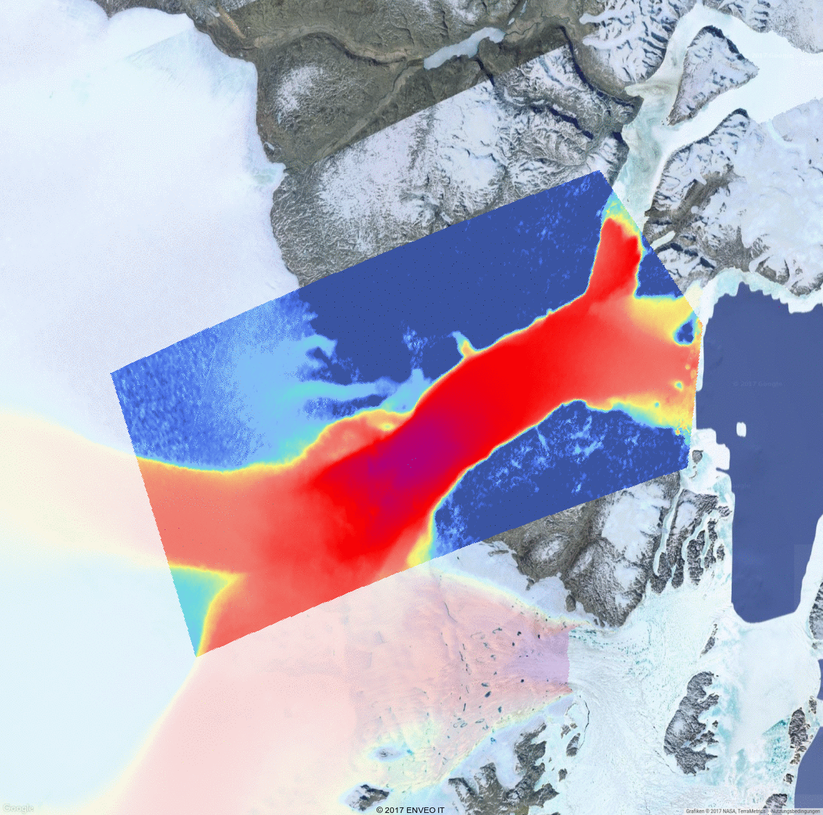
| IV |
Optical IV of Døcker Smith Glacier and between 2016-05-08 and 2016-05-18, generated using S2 data. |
13.3 MB |
2017-03-14 |
 |
| IV |
Optical IV of 79fjorden and Zachariae glaciers, between 2016-05-18 and 2016-06-18, using S2 data. |
18.1 MB |
2017-03-14 |
 |
| IV |
IV time series of Jakobshavn glacier 1992-2010 generated using ERS-1, ERS-2 and Envisat data. |
148.5 MB |
2017-03-14 |
 |
| IV |
Optical IV of Hagen Glacier between 2016-07-09 and 2016-08-26, generated using S2 data. |
10.7 MB |
2017-03-13 |
 |
| IV |
Optical IV of Helheim Glacier between 2016-05-04 and 2016-05-14, generated using S2 data. |
4.7 MB |
2017-03-13 |
 |
| IV |
Optical IV of Jakobshavn Isbræ between 2016-06-28 and 2016-07-08, generated using S2 data. |
13.4 MB |
2017-03-13 |
 |
| IV |
Optical IV of Petermann Glacier between 2016-07-09 and 2016-07-19, generated using S2 data. |
15.4 MB |
2017-03-13 |
 |
| IV |
Optical IV of Upernavik Isstrøm between 2016-08-02 and 2016-08-22, generated using S2 data. |
26.7 MB |
2017-03-13 |
 |
| IV |
Optical IV of Kangerdlussuaq Glacier between 2016-07-23 and 2016-08-02, generated using S2 data. |
14.8 MB |
2017-03-13 |
 |
| IV |
IV time series of Zachariae, 79Fjord and Storstrømmen 1991-2009 generated using ERS-1+2 and Envisat. |
278.6 MB |
2017-03-10 |
 |
| IV |
IV time series of Upernavik glacier 1992-2010 generated using ERS-1, ERS-2 and Envisat data. |
43.4 MB |
2017-03-10 |
 |
| IV |
IV time series of Petermann glacier 1991-2010 generated using ERS-1, ERS-2 and Envisat data. |
151.2 MB |
2017-03-10 |
 |
| IV |
IV time series of Kangerlussuaq glacier 1992-2008 generated using ERS-1, ERS-2 and Envisat data. |
16.9 MB |
2017-03-10 |
 |
| IV |
IV time series of Helheim glacier 1996-2010 generated using ERS-1, ERS-2 and Envisat data. |
5.7 MB |
2017-03-10 |
 |
| IV |
IV time series of Hagen glacier 1991-2010 generated using ERS-1, ERS-2 and Envisat data. |
106.7 MB |
2017-03-10 |
 |
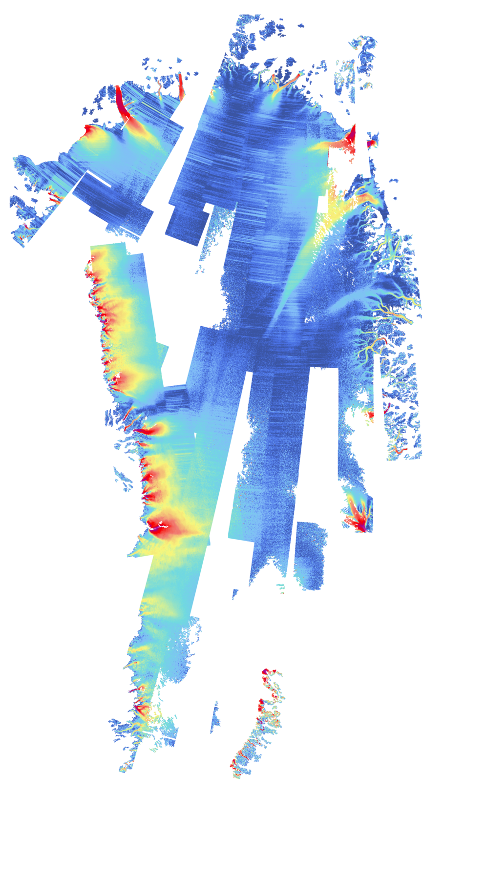
| IV |
IV map of Greenland from Sentinel-1 SAR data acquired from 2015-10-01 to 2016-10-31. |
440.2 MB |
2016-10-31 |
 |
| IV |
IV time series of Storstroemmen from Sentinel-1 SAR data acquired from 2015-01-26 to 2016-06-08. |
47.5 MB |
2016-07-05 |
 |
| IV |
IV time series of Zachariae Isstroem from Sentinel-1 SAR data acquired from 2015-01 to 2016-06. |
58.7 MB |
2016-07-05 |
 |
| IV |
IV time series of 79-Fjord Gletsjer from Sentinel-1 SAR data acquired from 2015-01-25 to 2016-06-08. |
52.9 MB |
2016-07-05 |
 |
| IV |
IV time series of Petermann Gletsjer from Sentinel-1 SAR data acquired from 2015-01 to 2016-06. |
57.5 MB |
2016-07-05 |
 |
| IV |
IV time series of Hagen Brae from Sentinel-1 SAR data acquired from 2015-01-22 to 2016-06-01. |
18.2 MB |
2016-07-05 |
 |
| IV |
IV time series of Kangerlussuaq Gletsjer from Sentinel-1 SAR data acquired from 2015-01 to 2016-06. |
47.2 MB |
2016-07-05 |
 |
| IV |
IV time series of Helheim Gletsjer from Sentinel-1 SAR data acquired from 2015-01-17 to 2016-06-11. |
29.8 MB |
2016-07-05 |
 |
| IV |
IV time series of Jakobshavn Isbrae from Sentinel-1 SAR data acquired from 2014-10-11 to 2016-06-02. |
31.3 MB |
2016-07-05 |
 |
| IV |
IV time series of Upernavik Isstroem from Sentinel-1 SAR data acquired from 2014-10 to 2016-06. |
96.4 MB |
2016-07-05 |
 |
| IV |
IV map of Greenland from Sentinel-1 SAR data acquired from 2015-12-23 to 2016-03-31. |
215.9 MB |
2016-06-27 |
 |
| IV |
IV time series of Jakobshavn Isbrae from SAR data acquired from 2002 to 2010. |
246.1 MB |
2016-06-15 |
 |
| IV |
IV time series of Upernavik glacier 1992-2010 generated using ERS-1, ERS-2, Envisat and PALSAR data. |
27.0 MB |
2016-06-15 |
 |
| IV |
IV map of the Greenland Northern Drainage Basin 1991-1992, derived from ERS1 data. |
55.2 MB |
2016-06-15 |
 |
| IV |
IV time series of Greenland margin 2006-2011 of winter IV generated from PALSAR data. |
87.7 MB |
2016-06-15 |
 |
| IV |
IV map of Greenland margin 1995-1996 winter generated from ERS-2 data. |
64.8 MB |
2016-06-15 |
 |
| IV |
IV map of Greenland derived from intensity-tracking of RADARSAT-2 data betweeen 2014-01 and 2014-04. |
169.6 MB |
2016-06-15 |
 |
| MFID |
Mass flow rate ice discharge (MFID) for Greenland from CCI IV, CCI SEC, and BedMachine |
347.5 KB |
2021-10-25 |
 |
| MFID |
Mass flow rate ice discharge (MFID) for Greenland from CCI IV, CCI SEC, and BedMachine
|
62.8 KB |
2020-04-28 |
 |
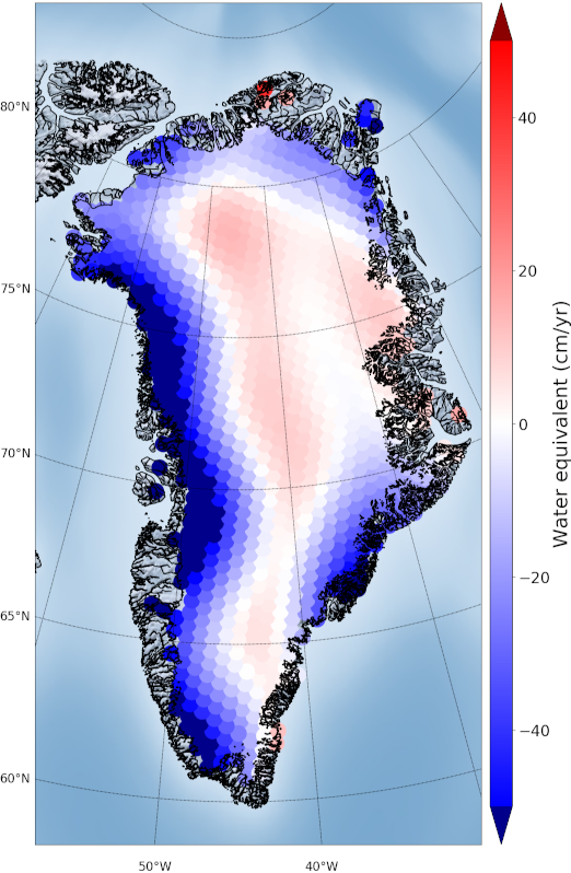
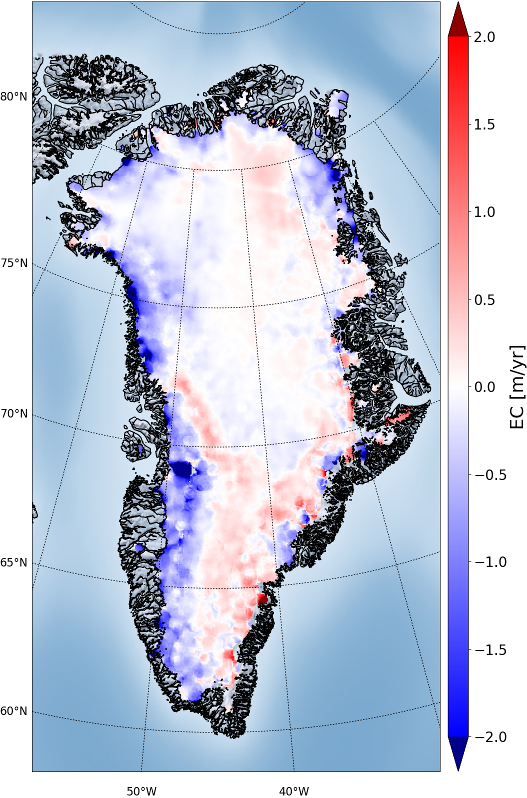
| SEC |
1992-2021 Greenland elevation change from multiple altimetric mission |
42.3 MB |
2021-10-27 |
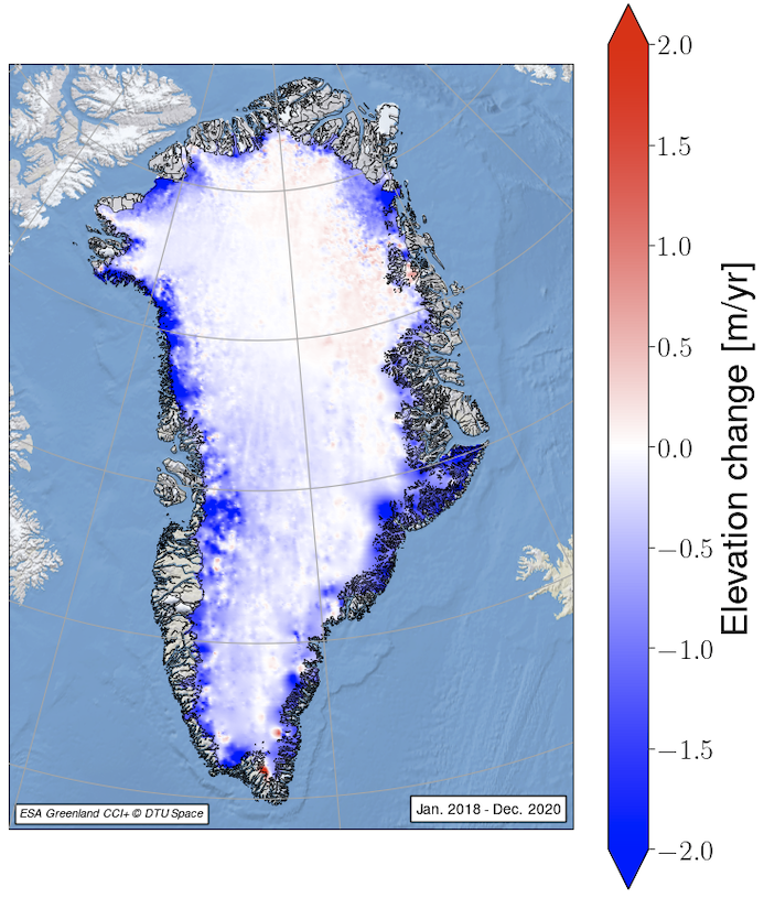 |
| SEC |
1992-2020 Greenland SEC from ERS-1, ERS-2, ENVISAT, Cryosat-2, and Sentinel-3 data, at 5-years means |
84.6 MB |
2020-09-24 |
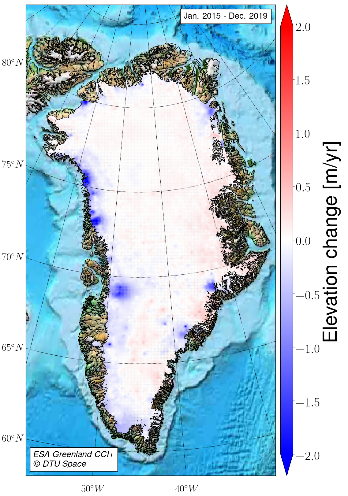 |
| SEC |
Greenland SEC grids from Cryosat-2. 2-yr and 5-yr means for 2011-2017 |
33.4 MB |
2018-04-19 |
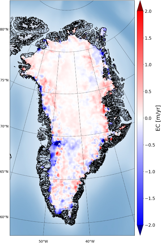 |
| SEC |
Experimental Greenland SEC grid from SARAL-AltiKa for 2013-2017 and corresp. grid from Cryosat-2 |
5.7 MB |
2017-11-09 |
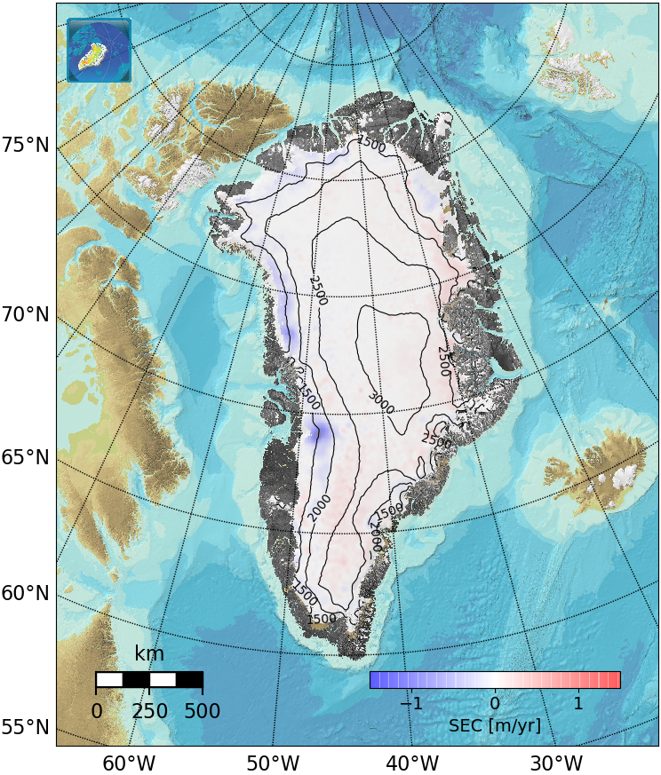 |
| SEC |
Greenland SEC grids from Cryosat-2. 2-yr and 5-yr means for 2011-2016 |
26.6 MB |
2017-03-13 |
 |
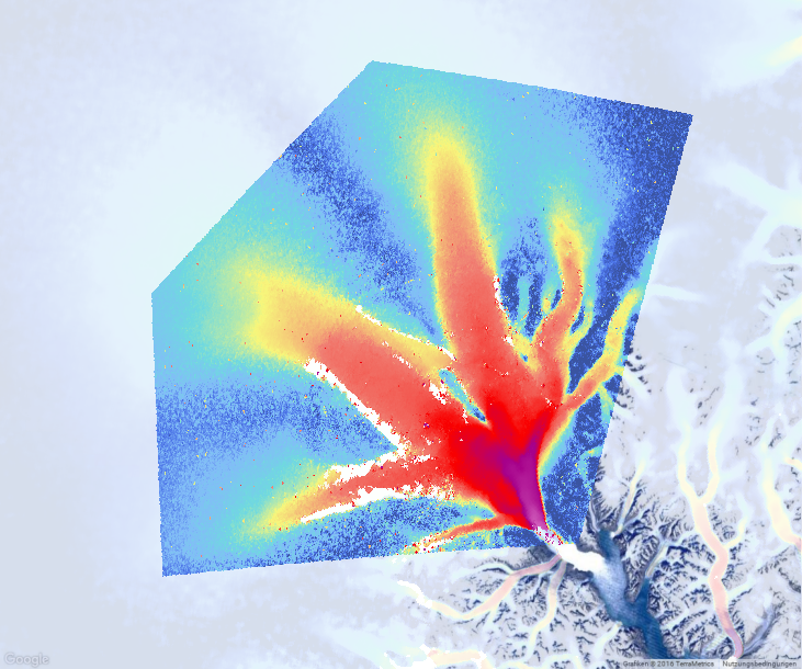
| SGL |
SGL delineation on 79 and Zachariae Glacier catchments for 2019/05/01-2019/10/01 using S2 data |
1.4 GB |
2022-01-19 |
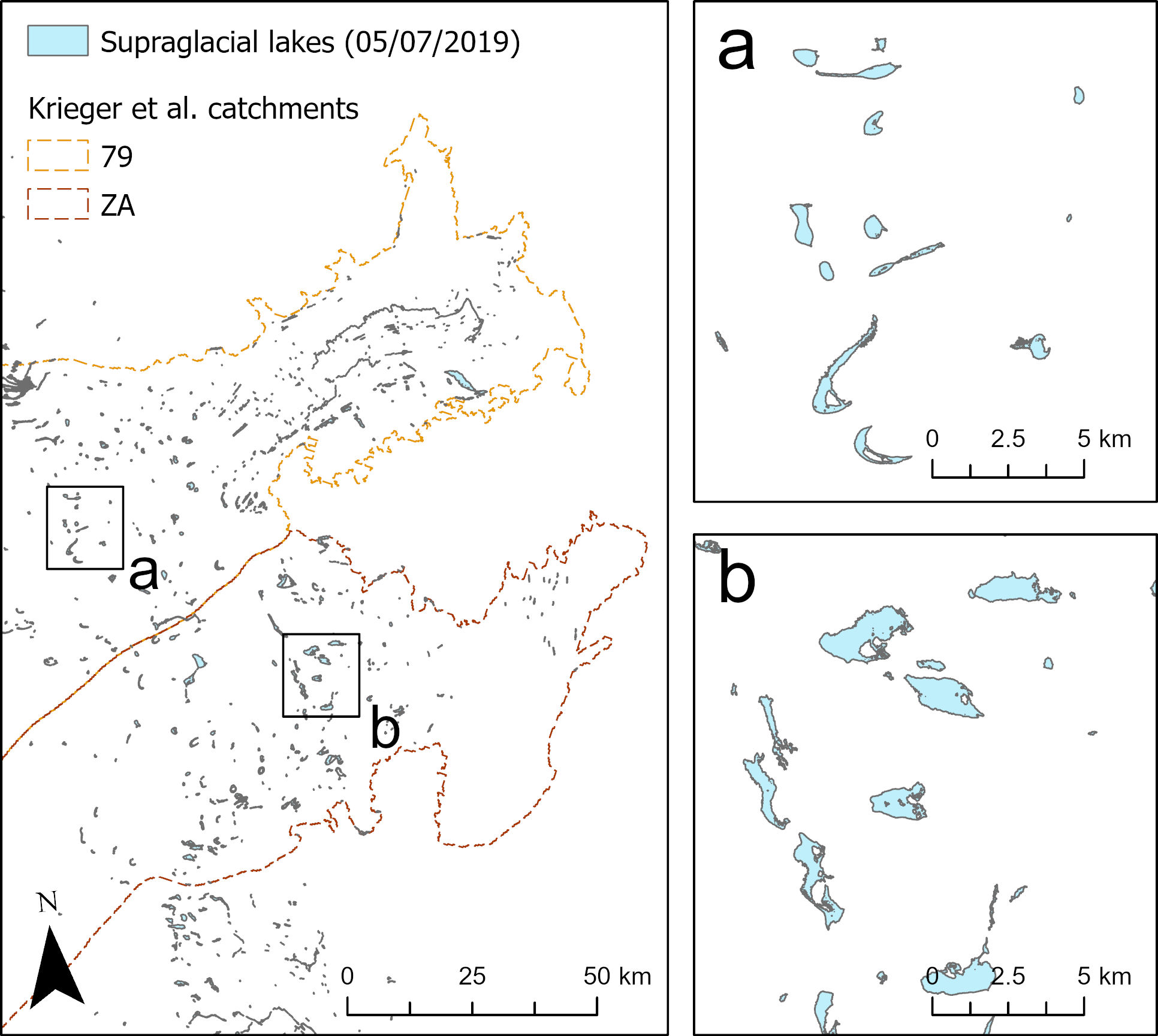 |
| SGL |
SGL delineation on Sermeq Kujalleq/Jakobshavn for 2019/05/01 and 2019/10/01 generated using S2 data. |
27.8 MB |
2020-04-28 |
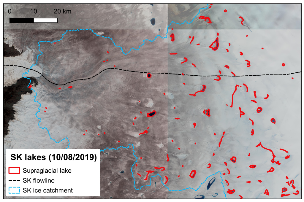 |
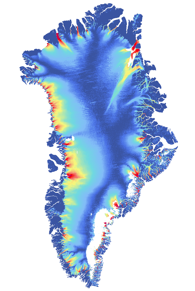
| none |
Digital Elevation model (DEM) for Greenland |
67.0 MB |
2018-04-19 |
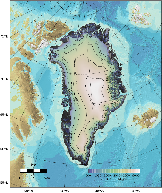 |